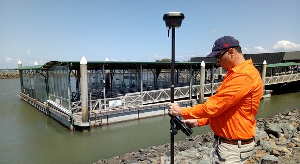
With the new visual positioning technology in the Leica GS18 I, marine and seawall surveys can be completed from dry land
Surveyors see unlimited uses for the new Leica GS18 I RTK rover with visual positioning technology
Rock seawalls are certainly a regular fixture up and down the southeast Queensland coast, and the team at Orion Spatial Solutions know them especially well.
They have climbed – and at times crawled – across a good number of them using traditional GNSS rovers.
But those days of getting uncomfortably close and personal with the surf and sharp rocks may be a thing of the past after they got the chance to try out the new Leica GS18 I, a GNSS RTK rover with new visual positioning technology that allows users to reach previously inaccessible or obstructed points safely and efficiently.
“It’s been a game-changer for us – it is almost like a mini mobile mapper,” says John Philipp, Spatial Solutions Manager with Brisbane-based Orion Spatial Solutions.
“The Leica GS18 I helped us greatly from a safety point of view. It means our staff can avoid climbing over rocks in order to get the waterline shots, and in general it will help keep our staff safer by avoiding similar risks,” Phillip says.
In their latest rover, Leica Geosystems has combined the lightening quick GNSS and tilt compensation of the well-received GS18 T unit with a camera so that users no longer must measure every single point with the pole tip.
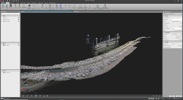
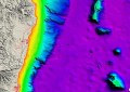
Point cloud data captured with the Leica GS18 I.
Due to the integration of GNSS, IMU and a camera, points with obstructed view to the sky and other inaccessible points can be measured from images using the Visual Positioning technology within the GS18 I. This new technology allows points of interest captured from a distance to be measured with survey-grade accuracy.
“It’s revolutionary,” says Rob Van Manen, Qld Survey Sales Manager for Leica Geosystems distributor CR Kennedy.
“Leica already changed the game with the tilt compensation in the T version of the GS18, but obviously even more so now with the camera there,” he says.
“That’s why we’ve been so committed to putting it in the hands of customers, so we get some feedback from them, and the more we’ve done that, the more uses I’ve seen for it.”
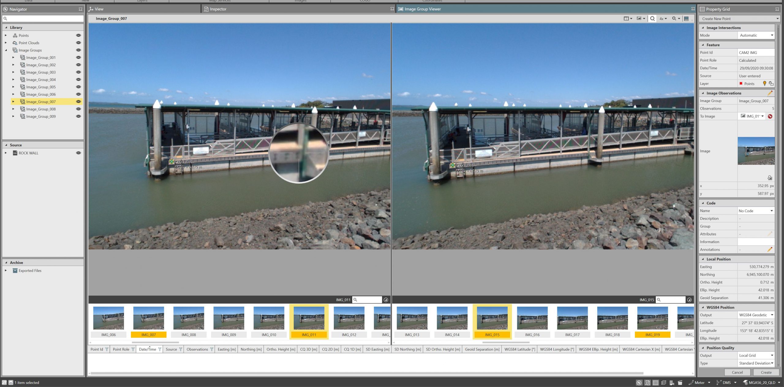
The GS18 I allows users to collect large amounts of data and imagery onsite and decide later about which points to measure in survey-grade accuracy
In just the short time that the team at Orion Spatial Solutions have had their hands all over the GS18 I, they have found dozens of uses – many of which have surprised Spatial Solutions Manager John Philipp.
“Because it’s so new, we still haven’t even scratched the surface when it comes to where and when we’re going to use it,” he says.
“But if you’ve got it on you all the time, all of a sudden you think, ‘Oh, that’s an easy way to do it, I’ll be out of here quick because of the added capability of the camera on the GS18 I.”
Philipp says he was happy his team had the unit on them recently during some key work on one of their bigger projects, an industrial subdivision requiring earthworks verification.
He says with all the work happening at the site, stockpiles and material might have moved by the time they could get a drone in the air and their controls down.
“Within 20 minutes the controls are gone, and the scrapers are ripping it out, but now we have the ability to just pull up and grab that GS18 I out and walk around the stockpile or down a strip if they’ve got scrapers running,” he says.
“We can check what depth they’re at without even getting in – that sort of thing has been good in the construction side of it,” he adds.
Philipp says his team has also found the GS18 I to be a big help when doing road surveys, allowing them to pay attention to traffic and other hazards, while still getting the job done quickly and accurately.
“The camera just takes it to the next level because you can say I’d rather just do that with a camera and grab it when I get back to the office,” he says.
“Also, it certainly helps with overhead power lines, traffic lights, and objects or features which you can’t always easily get with an instrument because your angle might require another couple of setups.
“With the GS18 I you can just quickly capture that and get it back in the office,” he says.
If you or your team would like to see what you can do with the new
Leica GS18 I with visual positioning technology, get in touch with CR Kennedy on +61 3 9823 1533.
Information provided by CR Kennedy.