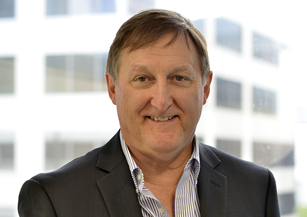
Spatial Vision’s Glenn Cockerton
In an exclusive from Position magazine, we highlight one of the Australian geospatial industry’s stalwarts, as they celebrate a major milestone in 2019. Defined by its core values, Spatial Vision has nurtured a growing, profitable enterprise with a highly developed organisational culture, one firmly grounded in a strong social and environmental conscience. We sat down with managing director Glenn Cockerton to better understand Spatial Vision’s journey.
Position: Glenn, congratulations on a 20-year anniversary for Spatial Vision this year. Can you tell us a little about how things were when Spatial Vision started out? How did you get your foothold?
GC: Spatial Vision started operations in June 1999, initially working out of a disused lecture theatre at RMIT University. The company soon moved out to dedicated premises in Queens Road Melbourne. Growth over the next ten years saw us progressively take over multiple floors.
Our work was initially focused on Victorian public sector clients such as the departments of Sustainability & Environment, Primary Industry and Education but we soon began to target NSW and spent many trips to Sydney gaining a number of NSW government clients including Land and Property Information, National Parks and Wildlife Service and the RFS. We also commenced production of the award winning Vicmap Book series for Victoria’s emergency services.
The last decade has seen our business consolidate with a client base that extends throughout Australia and more recently overseas in Canada, the Middle East and south east Asia.
Position: What do you think are most important shifts that have occurred in the past two decades – what hard lessons have been learnt, which critical trends has Spatial Vision had to stay out in front of, which practices and technologies were imperative to adapt to?
GC: The last twenty years has seen a seismic change across the industry. GIS has moved from being something done by boffins in the back office, to a mainstream technology (we largely have Google Maps to thank for this). The interoperability and open data movements have massively improved the availability of foundational geospatial data sets. The advent of cloud resources and mature web services have meant that these data are now accessible by all, with many users being relieved of the need to manage third party mapping data. Effective and economical web mapping technologies, and more recently mobile apps, have put fit for purpose tools in the hands of work forces, contractors and/or the public. Precise location systems are underpinning a whole host of applications including mining, AgTech, intellimatics and many other areas. Drones equipped with multiple sensors have made data capture cheaper and richer at scales never before feasible. An explosion in the fleet of satellites means that there has never been more remotely sensed data available, rapidly increasing in both geospatial and temporal resolution. Virtual worlds (including IoT, BIM and digital twin technologies) are enabling us to simulate urban environments, model utility networks, forecast transportation needs etc. Now the promise of federated architectures is offering a truly connected ecosystem of geospatial infrastructure that is so much more than traditional SDIs. Blockchain, artificial intelligence and machine learning are the latest developments and offer huge potential to further transform our industry.
For Spatial Vision, we had to invest significantly in to build capacity in many of these emerging technology areas. The pace of change is such that this process remains unending, requiring us to commit to the technical and profession development of our staff, revisions to our service offer and our understanding of the needs of the markets we serve. For a medium sized company, this remains a challenge. A key strategy is to work collaboratively where ever we can – with our clients, leading researchers and universities and other companies – or, if necessary, on our own.
Spatial Vision has invested heavily in software development including cloud, web-mapping and mobile technologies, key middle-wear offerings (such as GeoCortex), and agile project delivery, as well as artificial intelligence and machine learning.
Position: In celebrating this anniversary, I note the use of language: ‘Making a difference’ – along with an overt commitment to ‘making a positive difference regarding climate change, environmental sustainability and social equity’. How is this implemented in practice in terms of leadership and policy within the company?
GC: For much of our life, our company has let our project work effectively ‘do the talking’ for us. But in the last five years, we have realised that our staff and clients are looking for a clearer understanding of what our company stands for – in other words, our purpose.
To this end, we have completed a process to define and up-hold our core values, looking to reflect these in our operations across the company. These values have been underpinned by a number of statements about environmental sustainability and social equity – and importantly, how we, as a company, can make a difference, in terms of both the work we deliver, and how we operate our company.
We have also taken the step to declare a position on climate change, on the basis that we believe that this issue is one that demands greater recognition and attention. This has been done in the hope that more can be achieved, faster to ensure climate impacts are contained within sustainable levels.
We are not just talking about climate – we are actively reviewing our company operations to utilise renewable forms of energy and are seeking to initially fully offset our carbon emissions (our target is 2020). We are then planning on implementing a strategy to progressively reduce emissions for the future.
Whilst these statements have been developed with management support, importantly they have also benefitted from input from our staff. Surveys confirm that these actions have been well received by our staff.
Position: How might it affect choice of partners and projects – is there an internal procedure or process to maintain consistency with these values?
GC: Our values are embedded in a number of operational processes although we acknowledge that there is more we need to do in this area. As for choosing projects and partners, we have made a definitive statement: “We look for opportunities to partner with government agencies, companies and not-for-profit organisations to address problems and deliver outcomes that are mutually beneficial and sustainable… our company will not accept projects that do not meet these principles.”
To date, we haven’t encountered many situations where we have had to test ourselves on this issue but so far we are more than happy with our position.
Position: What is your view on the role of corporates in the face of unprecedented global challenges – such as in the case of the climate crisis, given the window that we have to act on it, and a government dedicated to policies that will see emissions continue to rise?
GC: This issue is certainly topical, with the current PM and others expressing the view that this is not a role for business. With respect, we (amongst a large number of other corporates) disagree. This issue requires us all to take responsibility for its resolution – and to take the actions required to deliver a sustainable outcome, be it the climate, or our environment more generally.
Position: In terms of the outlook for Australia’s spatial industry, what do you see as the most important dynamics to have played out in recent years, and how might they determine the course of the industry over the next few?
There are many, so I’ll try to be brief. The re-shaping of CRCSI into FrontierSI has been an impressive and promising transition. The contribution of CRCSI’s major projects such as Digital Earth Australia and the Satellite Based Augmentation System will be felt for years to come. The advent of the new Space Agency, along with the SmartSAT CRC and the nexus between space and spatial are a welcome set of developments with much potential also.
Position: Do you have any key highlights or standout moments from Spatial Vision’s 20 years that you’d like to end with – outcomes you’re most proud of?
GC: There have been a number of significant milestones for our company over the last 20 years – I am not sure that they would be particularly notable to the readers of Position magazine!
I believe that the greatest highlight is that fact that, after 20 years, Spatial Vision is stronger than we have ever been; we are enthusiastically chasing new business and growth opportunities; we are continuing to invest in our people; and we are increasing our capabilities and capacity for the future. Here’s looking to the next 20 years!
Position: Congratulations again Glenn, and thanks for your time.
Stay up to date by getting stories like this delivered to your mailbox.
Sign up to receive our free weekly Spatial Source newsletter.