

Australian drone manufacturer Carbonix has inked a drone training agreement with Toll Uncrewed Systems, a part of Toll Aviation and a provider of UAS flight operations and training.
The deal will see Toll become the primary training organisation for Carbonix drones in Australia.
“We are delighted to form a partnership with Toll Uncrewed Systems, whose expertise in training and operations will broaden our own future growth and development,” said Carbonix‘ CEO, Philip van der Burg.
“This partnership will allow us to focus and scale on our core business of developing highly effective drone platforms and equipping them with best of breed sensors that will enhance existing long range operations, and ensure that world class training is available across the board.
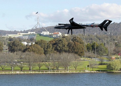
Carbonix’ UAV platforms are larger than the typical drone and have longer range, and can be equipped with a variety of payloads, including LiDAR, photogrammetry, ISR and multi-spectral sensors.
This, combined with their fixed-wing flight with VTOL capabilities, makes them suitable for executing expansive aerial surveys, particularly in remote terrain.
A Carbonix aircraft recently became the first Australian fixed-wing VTOL drone to execute a fully automated beyond-visual-line-of-sight mission, gathering remote critical data for a power network customer.
“An official partnership with Carbonix is an alignment with our own values supporting sovereign entities in the uncrewed world,” said Toll Uncrewed Systems’ Chief Pilot, Wayne Condon.
“Our experienced trainers are excited about the opportunity to work with an Australian-based manufacturer and match these sophisticated platforms with Australian training excellence.”


