Satellite data has been used to show that Earth's plants now absorb 606 million tonnes less carbon than they did ten years ago, according to a new study.
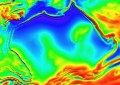
The study, published in the journal Science, used data from a NASA satellite that orbits Earth every 15 days to build up a global map of changing leaf density and forest cover.
It estimated net primary production – a measurement of how much CO2 is taken in by plants and stored as part of their biomass – and shows that the amount of carbon dioxide being soaked up by the world's forests in the past decade has recently declined sharply, reversing a 20-year trend.
Compared with a 6 per cent increase in plant productivity during the 1980s and 1990s, the decline observed over the last decade is only 1 per cent. The shift, however, could impact food security, biofuels and the global carbon cycle, the study says.
Steven Running of the University of Montana said the results were not expected.
“We see this as a bit of a surprise, and potentially significant on a policy level because previous interpretations suggested global warming might actually help plant growth around the world,” he said.
A fierce drought that dried out vast areas of the Amazon Basin in 2005 is seen as a key to the global decline in carbon sinks in the past decade.
The researchers want to continue monitoring these trends in the future because plant productivity is linked to shifting levels of greenhouse gas carbon dioxide in the atmosphere and stresses on plant growth that could challenge food production.
Scientists say that a sustained decline in the amount of carbon being stored in forests risks locking in a vicious cycle, in which trees absorb less carbon because the world is warmer and drier, while the rising carbon levels in the atmosphere continue to trap heat.