GIScience 2025, the 13th International Conference on Geographic Information Science, will be hosted by the University of Canterbury in collaboration with the GIScience academic research community across New Zealand.
The GIScience conference regularly attracts more than 250 international participants from academia, industry and government to discuss and advance the state-of-the-art in geographic information science.
The first day of the 2025 conference will be dedicated to workshops and tutorials, while the main conference program will run on the second and third days; it will include a single refereed paper track and an abstract track for posters and demo submissions.
GIScience 2025 welcomes papers, posters and demos covering emerging topics and fundamental research findings across all sectors of geographic information science, including (but not limited to) the role of geographic information in geography, computer science, engineering, information science, linguistics, mathematics, cognitive science, philosophy, psychology, social science and geostatistics.
Deadlines:
- Proceedings papers: 31 January 2025
- Workshop proposals: 14 February 2025
- Abstracts: 4 April 2025
- Demos: 4 April 2025
Image credit: ©stock.adobe.com/au/StudioProX

The INTERGEO EXPO and CONFERENCE brings together hundreds of exhibitors and thousands of delegates from around the world, to discuss with, learn from and network with others in the sectors of geodesy, geoinformation and land management.
The event presents an opportunity for vendors to showcase their innovative geodata-based solutions to an international audience over three days, addressing current challenges such as climate change, urbanisation and sustainable land use.
The 2024 event in Stuttgart attracted more than 550 exhibitors and more than 17,000 visitors.
The Free and Open Source Software for Geospatial (FOSS4G) conference series, hosted in partnership with OSGeo, brings together open source geospatial users, software developers, decision makers and researchers from around the world.
The FOSS4G 2025 conference in Auckland, New Zealand, will be a vibrant gathering that fosters collaboration and celebrates innovation in the exciting world of free and open source software for geospatial.
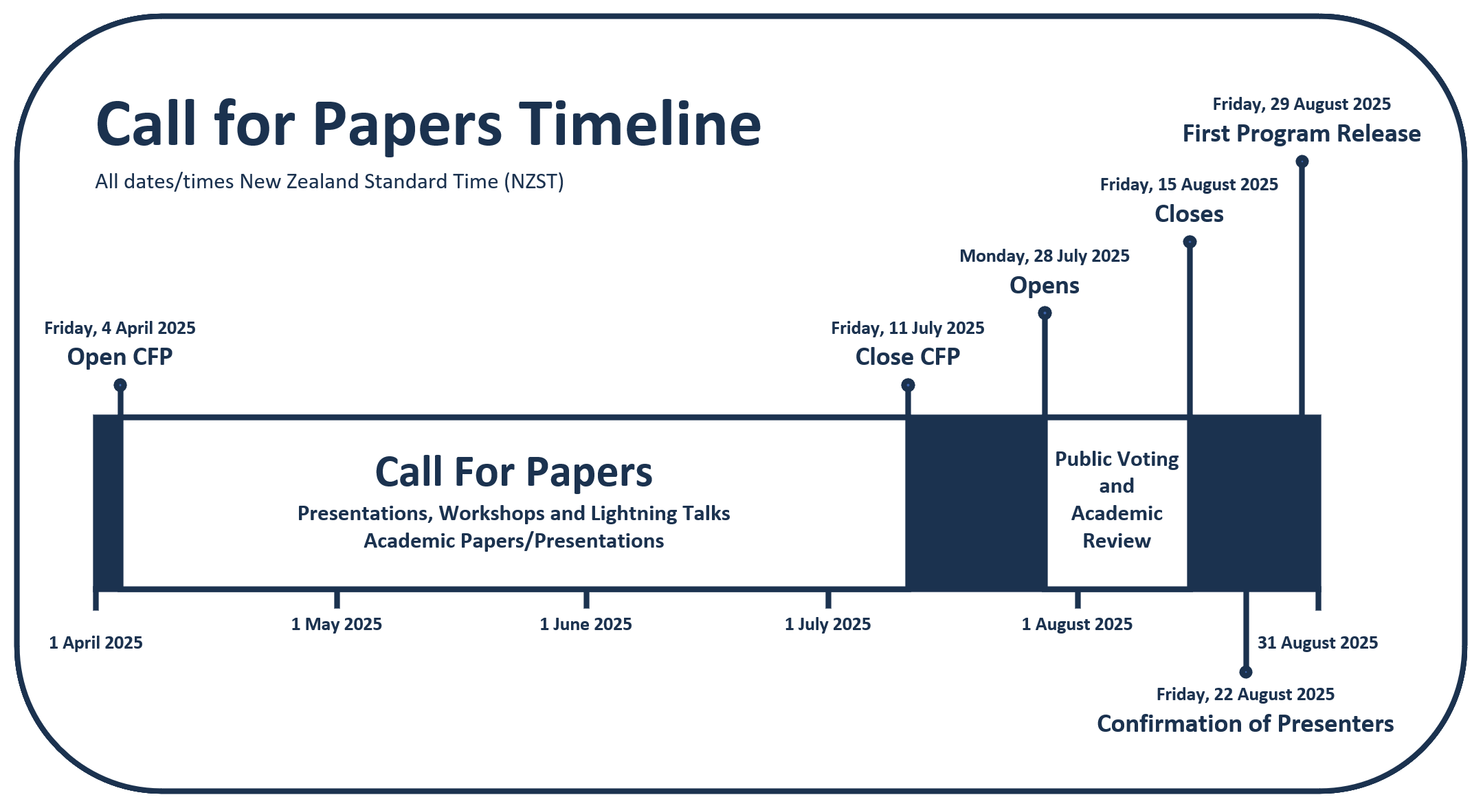
The event will feature workshops, technical sessions, keynote addresses, ‘lightning talks,’ code sprints and community events, social events and a ‘women in geospatial’ breakfast.
It is expected that the full program will be made available in August 2025.


