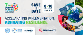
The United Nations Committee of Experts on Global Geospatial Information Management (UN-GGIM), in collaboration with the Government of México through Instituto Nacional de Estadística y Geografía (INEGI) will convene the Seventh High-level Forum on United Nations Global Geospatial Information Management with the theme ‘Accelerating Implementation: Achieving Resilience’.
This seventh edition of UN-GGIM’s High-level Forums will continue UN-GGIM’s regular high-level, multi-stakeholder discussions on global geospatial information management, through the convening of global forums, aimed at promoting comprehensive dialogue among member states, and between member states and relevant international organisations, UN system entities and stakeholders.

The complexities of understanding and forecasting evolutionary processes necessitate geographic modelling and simulation, which have emerged as potent tools for addressing critical issues such as climate change and sustainable resource use. But there is a pressing need for an open geographical modelling and simulation framework. Such a framework would serve as a catalyst, attracting more scholars and encouraging their collective efforts to address geographic challenges.
This workshop is designed to explore pertinent theories, approaches and potential applications, while fostering communication among experts from diverse domains. Its primary objectives include stimulating extensive discussions regarding the potential directions of the field and promoting further research, thus paving the way for a promising future in collaborative geographic modelling and simulation.
Organisers:
- School of Geography Science, Nanjing Normal University, China
- Key Laboratory of Virtual Geographic Environment (Ministry of Education of PRC), Nanjing Normal University, China
- International Geographical Union – Modeling Geographical Systems Commission
Co-organisers:
- International Environmental Modelling and Software Society
- The International Association of Chinese Professionals in Geographic Information Sciences
- Geographic Model and Geographic Information Analysis Commission, The Geographical Society of China
- Working Group on Education and Capability Building for Digital Earth, International Society for Digital Earth
- Jiangsu Center for Collaborative Innovation in Geographical Information Resource Development and Application, China
- National Earth System Science Data Center – Yangtze River Delta Subcenter
- School of Environment, Nanjing Normal University
Important dates:
- Abstracts due: 20 August 2024
- Early-bird registration ends: 31 August 2024

The 2024 Western Australian Geospatial Conference will be a dive deep into the latest technologies, trends, and best practices shaping the geospatial sector in Australia. The conference will give professionals ranging from GIS specialists to remote sensing experts the chance to gain valuable insights and forge new partnerships.
The event will conclude with the 2024 Western Australian Geospatial Excellence Awards ceremony, which will celebrate achievements and innovations by individuals and organisations within Western Australia’s geospatial sector.

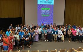
The 2024 Pacific Islands GIS & Remote Sensing Users Conference is reputably the largest GIS and remote sensing conference attended by Pacific Islanders, who leverage this annual opportunity to network and pursue partnerships with practitioners from around the globe.
The conference spotlights the latest innovative technologies, promotes knowledge and capacity development and sharing of best practices, and attracts a gathering of more than 300 attendees.
The theme for the 2024 event will be ‘Sustainable management of coastal areas through remote sensing and GIS.’


