

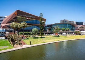
South Australia’s Spatial Information Day (SID) will be held on Friday, 7 August at the Adelaide Convention Centre.
An annual highlight of the South Australian geospatial community’s calendar, SID brings together experts from the fields of surveying, GIS, remote sensing, photogrammetry and more, for wide-ranging discussions and networking.
The theme for 2026 is ‘Every future starts somewhere: From ground truth to space, shaping what comes next,’ and for 2026 the organisers are hoping to attract around 400 delegates and 40 speakers. This year will also see the introduction of the inaugural South Australian EISSI Awards Dinner.
The call for abstracts and papers is now open, with speakers invited to submit their ideas within a wide span of topics, such as:
- Various spatial disciplines, e.g. GIS, surveying and so on;
- Real-world case studies;
- Insights into innovation techniques and approaches;
- Smart cities and infrastructure;
- Emerging technologies.
A sponsorship prospectus is now available, while tickets for the event are expected to go on sale soon.

GeoCart’2026, Aotearoa New Zealand’s 12th National Cartographic Conference, will convene from 26 to 28 August at the Te Aro campus of Victoria University of Wellington.
The event aims to bring together a wide cross-section of professionals, researchers, and enthusiasts engaged in cartography, map curatorship and research, geovisualisation, and GIS.
Participants at GeoCart’2026 will hear about the latest developments and research, learn about current and upcoming projects and products, network with their counterparts in the greater community, and develop a deeper understanding of cartography and mapping.
The deadline for abstract submissions is 15 May 2026.
In addition to the main conference, there will also be a pre-conference Map Design Workshop that will explore techniques for terrain visualisation, feature symbology and layout composition.
Plus, entries are invited for the NZ National Map Exhibition 2026, all of which will be put on display and judged during the conference. Subject to the number and quality of entries received, a winner will be announced for each of two categories: Printed Map Product and Digital Map Product. All entries from New Zealand domiciled cartographers will be eligible for selection to represent New Zealand at the 2027 ICA International Cartographic Exhibition in Vancouver, Canada.

The Survey and Spatial New Zealand Conference 2026 aims to connect the surveying and spatial community to explore innovation, technology and the future of the profession.
The event will attract professionals from across land development, urban design, resource management, civil engineering, surveying (cadastral, hydrographic and engineering), positioning and measurement, and spatial/GIS for two days of insights.
Registrations are due to open in April 2026.
Image credit: ©stock.adobe.com/au/StudioProX