

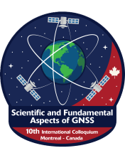
The 10th International Colloquium on Scientific and Fundamental Aspects of GNSS will bring together members of the European scientific community and international partners involved in the use of Galileo and other GNSS in their research.
The colloquium will address several major areas of research:
- Scientific applications in meteorology, geodesy, geodynamics, geophysics, space physics, oceanography, land surface and ecosystem studies;
- Scientific developments in physics with a potential impact on future GNSS, particularly in testing fundamental laws of physics;
- Aspects of metrology such as reference frames, on board and ground clocks, precise orbit determination and time and frequency transfer; and
- Scientific aspects of satellite navigation, positioning and its applications, such as signal propagation, precise positioning;
The conference will be organised as a series of plenary talks, parallel half day sessions and poster presentations.
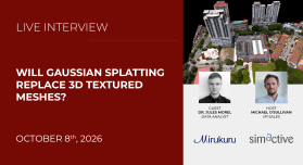
Gaussian splatting is rapidly gaining attention as a new way to create highly realistic 3D representations from imagery. But beyond impressive visualization, what can Gaussian splats actually be used for in photogrammetry? Join our guest Dr. Jules Morel, Data Analyst at Mirukuru in Japan, as we examine how Gaussian splats are created, what is required to achieve high-quality results, and where the technology fits within real-world photogrammetry workflows. We will also compare Gaussian splats with traditional textured meshes and discuss when each approach makes sense.
Specifically, attendees will learn about:
- Understanding the fundamentals of Gaussian splatting
- Capturing and processing imagery for high-quality results
- Using Gaussian splats for visualization and measurement
- Comparing splats with traditional textured meshes
The Victorian Excellence in Surveying and Spatial Information (EISSI) Awards presentation ceremony will be held on 10 October 2026 at The Leaper Family Pavilion, Arts Centre, Melbourne.
The EISSI Awards recognise and reward the best that the surveying and spatial profession has to offer, including organisations and firms that demonstrate innovation, leadership, and technical brilliance in the field of surveying and spatial information services.
The Institution of Surveyors Victoria and Consulting Surveyors Victoria are once again collaborating to deliver this prestigious event, celebrating excellence, innovation, and achievement within the surveying profession across Victoria.
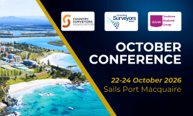
The NSW Country Surveyors Association October Conference will be held in Port Macquarie, from 22 to 24 October 2026
The three-day program will bring together surveyors, industry leaders and key stakeholders for practical updates, technical learning and professional connection.
Sessions will cover cadastral practice, cyber security, succession planning, mental health, service location, digital/CAD developments and sector updates.
A Partners Program will run on Friday and Saturday and will include the Friday Conference Dinner and Saturday Family Dinner.

The Institute of Public Works Engineering Australasia’s (IPWEA) International Asset Management Summit 2026 will bring together leading professionals, decision-makers, and innovators from across Australasia to explore the future of asset management.
Hosted by IPWEA, this two-day event is designed to address the challenges and opportunities facing our sector as we build sustainable, resilient, and technology-driven infrastructure for communities.
The Western Australia Excellence in Surveying and Spatial Information (EISSI) Awards presentation ceremony will be held on Friday, 30 October 2026, at the Pan Pacific, Perth.
The EISSI Awards recognise and reward the best that the surveying and spatial profession has to offer, including organisations and firms that demonstrate innovation, leadership, and technical brilliance in the field of surveying and spatial information services.
The event, to be held in conjunction with the Western Australian Institution of Surveyors’ (WAIS) October Conference and AGM, will be hosted by Surveyors Australia in partnership with WAIS.
The 2026 Advancing Earth Observation Forum aims to bring together professionals from across Australia and beyond, to share, learn, connect and collaborate.
The four-day event promises to attract a diverse range of participants from the Earth observation community, including those in industry, government, research, defence, not-for-profits and educational institutions.
The 2026 Forum will build on the momentum generated at the 2024 event in Adelaide and the inaugural AEO Forum held in Brisbane in 2022.
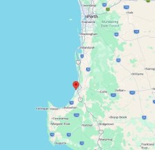
The Western Australian Institution of Surveyors’ (WAIS) annual South West and Great Southern Surveyors Conference, also known as SWAGSS, will be held in the seaside town of Bunbury on Friday, 13 November 2026.
The day will be filled with insights, networking prospects and valuable professional development opportunities, featuring a dynamic program designed to cover critical topics in surveying.
Delegates can attend in person or via livestream.

Locate is Australia and New Zealand’s flagship geospatial event, where the region’s smartest minds meet to explore the technologies, ideas and innovations shaping our world.
Each year, leaders from government, industry, research, and emerging sectors come together to uncover the latest breakthroughs and real-world applications transforming infrastructure, environment, agriculture, energy, mining, emergency response, and urban planning.
If you want to stay ahead of spatial trends, connect with decision-makers, and be part of the conversations driving smarter, data-led futures, this is the place to be.
Locate26 will be held at the Melbourne Convention and Exhibition Centre from 24 to 26 November.
Co-located with Locate26 will be the 2026 Digital Earth Summit, a major annual global conference of the International Society for Digital Earth (ISDE).
The ISDE has brought together global experts for more than two decades, delivering world-leading summits and symposia across 15 countries. In 2026, the combination of the Summit and Locate26 will bring a unique international gathering of scientists, industry innovators, educators and government leaders to Australia.
Organisers expect up to 1,000 delegates to attend the combined conference, making it a not-to-be-missed opportunity for speakers to share their news and views, and for companies and organisations to promote their products and solutions to a prime audience.
Early bird registrations close on 14 September. Only one registration is needed to access all sessions across the joint event.
The program is out now, detailing more than 140 presentations of various kinds – talks, plenaries, panels, discussions and more.
With a theme of ‘Strengthening and Expanding Geospatial Networks in the Pacific Islands,’ the 2026 Pacific Islands GIS & RS User Conference aims to build and enhance geospatial networks in the Pacific Islands by being a forum where experts, practitioners and policymakers can explore cutting-edge geospatial technologies and collaborations.
The conference is the largest GIS and remote sensing conference attended by Pacific Islanders, attracting more than 300 attendees every year. The event will offer a unique platform to share knowledge, strengthen regional partnerships, and drive innovation in mapping, remote sensing and spatial data infrastructure.

