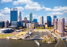
The Geospatial Council of Australia’s Western Australia Digital Twin Summit will be held on 15 November 2023.
The event will focus on Spatial Digital Twins, and attendees will hear the latest developments in this rapidly developing space from government, academia and private industry presenters.
The WA Asia-Pacific Spatial Excellence Awards dinner will also be held in conjunction with the conference, celebrating the outstanding work being undertaken across the region.
Image credit: ©stock.adobe.com/au/anekoho

The 2023 ACT Geospatial Conference and Excellence Awards will bring together colleagues old and new to hear the latest updates from across the local geospatial industry.
The call for abstracts for the event is now open. Any topic of interest to the geospatial industry is welcome, including surveying (cadastral, engineering, hydrographic, mining), GIS, remote sensing and geodesy, or broader topics such as new technology, diversity and workforce management.
The deadline for submission of abstract proposals closes at midday on Tuesday, 3 October.
The Geospatial Excellence Awards Reception will be held at the conclusion of the conference sessions, giving attendees the chance to enjoy drinks and canapes whilst networking and celebrating the award winners.
Image credit: ©stock.adobe.com/au/r-o-x-o-r

Hosted by Eric Andelin CP, Senior Workflow Specialist with guest speaker Michael O’Sullivan, VP Sales, SimActive Inc.
It is often challenging for new entrants into the aerial imagery and mapping service profession to determine cost savings when it comes to their processing software solution. Smaller sensors, altitude restrictions, line of sight requirements and overall flight duration create unique challenges for drone operators. Medium and large format sensors acquire much larger areas, but require a much larger investment, or the ability to subcontract out the acquisition. Mapping expenses tend to increase as projects become larger. And using the wrong image processing software can exacerbate this, leading to narrowing project profits. This webinar will show how a higher-end software such as SimActive’s Correlator3D™ can reduce overall project costs. REGISTER HERE.
Specifically, attendees will learn about the following:
- Common challenges and impact on costs
- Cost variations as projects increase in size
- Workflows in Correlator3D to minimize man-hours
- Accelerating timelines with distributed processing

The Andy Thomas Space Foundation is looking forward to welcoming a global audience to the 16th edition of the Australian Space Forum, to be held in Sydney on 6 December 2023.
This will be the first time the Forum will have been held in a city other than Adelaide; the organisers announced at the 15th Forum in May 2023 that from then on, every second Forum will be held in a city other than Adelaide.
The Forum provides an ideal opportunity to stimulate ideas, share information about emerging technologies and network with influential space sector leaders and the broader community.

GeoBuiz Summit is an annual international conference focused on the geospatial industry, which encompasses a range of technologies and applications related to mapping, location-based services, and spatial data analysis.
The summit brings together industry leaders, government representatives, experts, and innovators to discuss the latest trends and innovations in geospatial technology and applications.
The conference covers a range of topics, including geospatial infrastructure, mapping and surveying, satellite imagery and remote sensing, location-based services, smart cities and urban planning, and much more. The GeoBuiz Summit aims to promote collaboration and knowledge-sharing within the geospatial industry and to showcase the latest developments in this exciting and rapidly evolving field.

The Institute of Navigation’s (ION) mid-year meeting, the International Technical Meeting (ITM), is a conference with a technical program related to positioning, navigation and timing and includes the ION Fellows and Annual Awards presentations.
In 2024, ITM will take place in Long Beach, California, January 22 – 25, 2024, and will be co-located with the Precise Time and Time Interval Systems and Applications Meeting.
A commercial exhibition and pre-conference tutorials will be held in conjunction with the conference.

The Institute of Navigation’s (ION) annual Precise Time and Time Interval Systems and Applications (PTTI) meeting will take place in Long Beach, California, January 22-25, 2024, and will be co-located with the ION International Technical Meeting.
The PTTI technical program is designed to:
- Disseminate and coordinate PTTI information at the user level
- Review present and future PTTI requirements
- Inform government and industry engineers, technicians, and managers of precise time and frequency technology and its problems, and
- Provide an opportunity for an active exchange of new technology associated with PTTI.
A commercial exhibition and pre-conference tutorials will be held in conjunction with the conference.

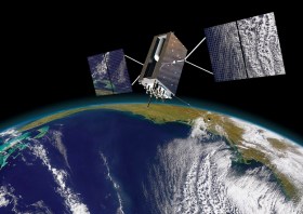
The IGNSS Association’s biennial international GNSS conference will return to UNSW Sydney from 7 to 9 February, 2024, where it will celebrate the first half-century of GNSS and look ahead to the next 50 years.
IGNSS 2024 will bring together experts, policy makers and emerging leaders from across the globe to examine the latest advances, present cutting edge research and discuss policy, market development and infrastructure.
The conference will also showcase Australia and New Zealand’s Southern Positioning Augmentation Network (SouthPAN), along with developments by other countries across the Asia-Pacific.
Topics to be covered at the conference will include:
- Autonomy on land, air, sea and in space
- Aviation and avionics
- Cooperative Intelligent Transport Systems
- Machine guidance applications in agriculture, construction and mining
- Maritime applications
- Uncrewed aerial systems
- Space applications of PNT in Earth orbit and for lunar and Martian exploration
- Positioning infrastructure
- GNSS vulnerability, resilience and risk
- Interference detection and mitigation
- Policies and standards
- SBAS and other augmentations
- Datums and geodesy
- National and international GNSS developments
- Emerging application areas for GNSS
- Key industries and their reliance on GNSS
- The multi-GNSS era
- Cyber security in PNT applications and infrastructure
- Alternative PNT
- State of the art in PNT algorithms and software development
- GNSS aiding and sensor fusion
- Positioning in GNSS denied environments
- Development of GNSS receiver hardware and firmware
- Precise position using smartphones
The organisers are encouraging early career researchers and industry representatives to present their work. The abstract submission process will open soon — keep an eye on the IGNSS website for announcements.
Image courtesy Lockheed-Martin

Geo Week is an event for increased integration between the built environment, advanced airborne/terrestrial technologies, and commercial 3D technologies. It was created as a response to the changing needs of built world and geospatial professionals, and to acknowledge the convergence of technology taking place currently.
New technological innovations, the need for remote workflows, and hardware breakthroughs are redefining expectations across teams, organisations, and entire industries will canvassed at the event.
Attendees will hear about the latest updates, case studies, ideas and predictions from a variety of experts: innovators, end-users, regulators, and more. What trends and technologies do they see coming? What new challenges and opportunities lie ahead? How can you and your organisation prepare, anticipate, and benefit in a rapidly evolving environment?

The Institution of Surveyors NSW (ISNSW) 2024 Annual Conference will be held over two days in February in the picturesque Blue Mountains, NSW.
Presented as a hybrid event, attendees will have the choice to join online or in person. Speakers will present on a wide range of topics, giving delegates the chance to hear from the industry’s best and network with them.
The event is open to ISNSW members as well as non-members.


