The Australian Institute of Mine Surveyors (AIMS) Mudgee Regional Seminar will be held at Parklands Resort, Mudgee, NSW, on 22 March 2024. There will also be an optional dinner at a local brewery the evening prior.
This annual event is always very well attended, and features presentations on a wide variety of mine surveying topics and technologies. You can read an account of the 2023 seminar on the AIMS website.

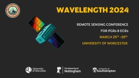
The Wavelength meeting was launched in 2013 for PhD students and early career researchers, addressing the demand for representation of new professionals as well as students from RSPSoc — the UK society for remote sensing and photogrammetry science.
Every year, Wavelength gathers participants from student and early career levels, as well as senior members and individuals within academia and business. The conference offers a setting to present student and EC work and meet new, like-minded contacts.
The 2024 conference will be run in a hybrid format, to accommodate those who can and those who cannot travel to Worcester.

C.R. Kennedy will be holding a national ‘Modern Methods of Construction Roadshow’ throughout late-February, March and April 2024, highlighting the ways in which the latest software, tools and technology are enabling businesses to streamline their operations.
Attendees will be treated to:
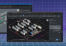
- A presentation on managing digital data workflow using BricsCAD, and the Leica iCON Total Station for efficient construction set out.
- A case study from a company using Leica technology.
- Information from Leica on some of the latest technologies in high-definition 3D laser scanning for accurate reality capture.
- Details of the latest underground detection technologies, such as locators and ground penetrating radar.
- Presentations on the latest in rotating lasers and handheld laser distance measurers (Leica distos) for quick and easy measurements.
- A look at how BricsCAD software can be used with each of these technologies to help bring all data and projects seamlessly together.
Time will be set aside for discussion, and demonstrations of each of the products will be made after the presentations.
The dates are:
- Melbourne: 28 February 2024, 9:00am to 1:00pm
- Sydney: 14 March 2024, 9:00am to 1:00pm
- Brisbane: 20 March 2024, 9:00am to 1:00pm
- Perth: 27 March 2024, 9:00am to 1:00pm
- Adelaide: 3 April 2024, 9:00am to 1:00pm
The cost is only $25 per head, and lunch will be provided. Registration details can be found here.
For more details, contact Bernie Edmonds at bedmonds@crkennedy.com.au.

The International Association of the IEEE-Geoscience and Remote Sensing Society (GRSS), the IEEE-Computational Intelligence Society (CIS) and the local organising committee invite geospatial and computing professionals to attend the International Conference on Machine Intelligence for GeoAnalytics and Remote Sensing (MIGARS) to be held in Wellington, Aotearoa New Zealand in April 2024.
MIGARS aims to explore the interface of machine intelligence approaches with geosciences, spatial analytics, and remote sensing. With the tremendous developments in remote sensing technology, data acquisitions and sensing platforms, digital data have grown leaps and bounds to stream and are too big by volume, variety, and veracity. The challenge is handling, processing, and automating geo-data from various sources, such as multi-platform remote sensors and IoT devices, informing decision-making and monitoring our planet.
The conference will focus on connecting researchers from various disciplines, including computation/artificial intelligence, engineering, remote sensing, hydrology, agriculture and geosciences, and look for the potential use of intelligent computational approaches for geo-data-based applications and for serving society at large.

The Institute of Navigation’s (ION) Pacific PNT Conference is a global event dedicated to the cooperative development of positioning, navigation and timing technology and applications.
The conference attracts policy and technical leaders from Japan, Singapore, China, South Korea, Australia, the United States and many other countries, who meet to discuss policy updates, receive program status updates and exchange technical information.
The conference will cover a wide range of topics:
- GNSS policy/status
- Polynesian navigation
- Aircraft navigation and surveillance
- Algorithms and methods
- Alternative navigation and signals of opportunity
- Aviation applications of GNSS
- Challenging navigation problems
- Emerging PNT consumer applications
- GNSS-R and GNSS-RO for environmental monitoring
- High-precision GNSS correction and monitoring networks
- Inertial navigation technology and applications
- Interference and spectrum
- Ionosphere monitoring with GNSS
- Natural hazards detection and other remote sensing applications
- Time and frequency distribution
- Space navigation technologies
Substantial discounts are available for early registrations.

The 2024 edition of the International Conference on Geographical Information Systems Theory, Applications and Management (GISTAM 2024) aims to create a meeting point of researchers and practitioners that address new challenges in geo-spatial data sensing, observation, representation, processing, visualization, sharing and managing, in all aspects concerning both ICT as well as management information systems and knowledge-based systems.
The conference welcomes original papers of either practical or theoretical nature, presenting research or applications, of specialised or interdisciplinary nature, addressing any aspect of geographic information systems and technologies, such as:
- Data acquisition and processing
- Remote sensing
- Interaction with spatial-temporal information
- Spatial data mining
- Managing spatial data
- Modelling, representation and visualisation
- GIS and climate change
- Domain applications

Each year, the Locate conference attracts hundreds of national and international delegates from within and outside the spatial, space and surveying sectors.
As Australia’s premier spatial and surveying conference, Locate provides guests with a unique opportunity to learn about the latest trends and applications in geospatial technologies.
The 2024 event will be held at the International Convention Centre at Darling Harbour in Sydney, and will include a gala evening dinner and presentation of the Geospatial Excellence Awards (formerly the Asia-Pacific Spatial Excellence Awards).
The convenor for Locate24 will be Narelle Underwood, Surveyor-General of NSW.

The New Zealand: Digital Twin 2024 Summit will explore the roadmap of digital twin systems and their impact on each stage of a project, and explore the core values, challenges and opportunities unique to the priorities of New Zealand and how digital twins can deliver them.
The event will feature real stories of success and failure, research insights, and focus not just on what has already happened but also on the potential of digital twins and where key opportunities for timely innovation appear to be.
Delegates will hear from technical experts, industry leaders and researchers in an experience designed to support the development of a dynamic and scalable digital twin ecosystem in New Zealand.

The 4th International Symposium on Applied Geoinformatics (ISAG2024), which will take place at the Wroclaw University of Science and Technology, Wroclaw, Poland, on 9 and 10 May 2024. ISAG2024 is jointly organised by the Department of Geomatics Engineering, Yildiz Technical University, Istanbul, Türkiye, Wroclaw University of Science and Technology, Wroclaw, Poland and Technical University of Crete, Chania, Crete, Greece.
The aim of the 4th ISAG is to bring scientists, engineers and industry researchers together to exchange and share their experiences and research results and discuss the practical challenges encountered and the solutions adopted in geoinformatics.
Topics to be covered include recent advances in AI, satellite imagery, advanced remote sensing, photogrammetry, image processing, global navigation satellite systems, height systems, terrestrial laser scanning, GIS, smart cities and land management.


