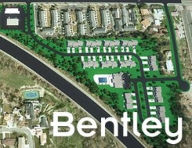
Join Bentley Systems at the launch of what it says is the industry’s most complete Survey and Site Design Solution ever offered to the ANZ market.
As technology advances and industry expectations increase, your software needs to keep pace with this ever-changing environment. In short, your software needs to deliver on today’s requirements and be ready for tomorrow’s challengers.
If you work in road design, site surveying, site development and related fields, this webinar is for you.
Throughout the launch, Bentley Systems will demonstrate traditional survey data capture capabilities, coupled with the latest mass data collection survey methods, including Total Station techniques, Point Cloud techniques and Digital Photogrammetry techniques.
Leveraging the above survey results, the launch will continue through a typical site design workflow, incorporating aspects such as:
- Terrain creation and analysis
- Urban road widening design
- Carpark and recreational area design
- Drainage and Utility design and analysis
- Plan production and digital model delivery
- Model visualisation
Air Inspect Australia will also be joining the webinar to share their insights and learnings of their project.
If you or your company perform any of the above-mentioned workflows, then this is one webinar you should not miss.

Update: This event has been rescheduled from its original date of 24 February.
The SSSI 2021 Victorian Surveying & Spatial Summit will be an opportunity for all Victorian surveying and spatial professionals to come together to learn, share and connect. The theme will be ‘Digital Transformation: Our Future’.
The one-day event will take place at the Novotel on Collins, Melbourne, and will be followed in the evening by the presentation of the Victorian Asia-Pacific Spatial Excellence Awards — the Awards celebrate the outstanding work being undertaken by individuals and organisations in the region.
Discounts are available for SSSI members and students. You can choose to register just for the Summit or select full registration which includes a ticket to APSEA-V event as well. Tickets for APSEA-V only (individual or full table of 8) are also available.
There will also be a pre-summit breakfast on the topic of Diversity and Inclusion, and organisers encourage potential participants to consider purchasing a ticket when registering for the Summit.

The theme for the Association of Public Authority Surveyors, NSW’s (APAS) 2022 annual conference will be ‘Surveying on the edge’. APAS was formed in 1994 to cater for needs of professionals in the surveying and spatial information industries working within state and local government and the education sector.
As a cooperating association of the Institution of Surveyors NSW and through its involvement with the Board of Surveyors and Spatial Information, APAS has a significant voice in the wider surveying and spatial information community.
Throughout history, surveyors have remained the pioneers of discovery shaping our world to its current existence by exploring the unknown on earth and in space. Fast forward to 2013 when the signing of the Budapest declaration created a common worldwide celebration for those leaders, past and present.
Global Surveyors’ Day is a way to globally recognise the ground-breakers, pioneers, individuals and the industry that has shaped our history and continues to be the foundation of our communities.
Image credit: ©stock.adobe.com/au/Yuttana Studio

The Australian Association for Unmanned Systems’ ‘RPAS in Australian Skies 2022’ conference aims to continue discussion on the safe integration of RPAS into Australian airspace. It is supported by key government and industry participants and has established itself as a landmark event in the Australian RPAS calendar.
The 2022 themes will cover:
- Policy and Regulatory updates from the Department of Infrastructure, Transport, Regional Development and Communications, CASA, AirServices Australia and the Australian Defence Force relating to the use of emerging aviation technology in Australia.
- UAS Traffic Management (UTM), low level airspace, integrated airspace systems challenges and opportunities.
- Industry challenges and perspectives
- Continuing development of a professional and safe industry.
- ATSB RPAS data and trends
- Emerging technology and innovative solutions enabling integration or RPAS into Australian airspace.
- Future infrastructure requirements to enable drone delivery and advanced air mobility (AAM).
- Emerging RPAS and AAM applications – benefits, viability and social acceptance.
The conference will be a hybrid event incorporating face to face (live) and online (virtual) choices for participants. It will also include the AAUS Gala Dinner featuring the AAUS Industry Awards.
The 10th Land Administration Domain Model Workshop (LADM 2022) will be held in Dubrovnik, Croatia from 31 March to 2 April 2022. This is an on-site event at Hotel Dubrovnik Palace, with possibilities for remote participation. The workshop is being organised in conjunction with 7th Croatian Congress on Cadastre.
Image credit: ©stock.adobe.com/au/incomible

The International Cartographic Association (ICA) Commission on Atlases, the ICA Commission on Map Design, the Joint ICA-IGU Commission on Toponymy, the National Geographic Institute of Spain (IGN) and the Spanish Society for Cartography, Photogrammetry and Remote Sensing (SECFT) will jointly host a conference on atlases, toponymy and map design in Madrid.
During six sessions of four presentations each, questions concerning evolving dissemination concepts and techniques for atlases, recent development and examples of national atlases as well as important map design and toponomastic issues in atlas production will be discussed.
The theme of the event will be ‘Atlases in time’. Presentations will be held in a 20-minute format of 15 minutes presenting and 5 minutes discussion.
The Country Surveyors Association of NSW Annual Easter Conference will be held on 22 and 23 April 2002, in association with Consulting Surveyors NSW, at the Remington Hotel, Orange, and online.
The program includes an update from the NSW Surveyor General; other legislative, regulatory, training and cybersecurity updates; and case studies covering a variety of topics, eg. ‘Sealing the Silver City and Cobb Highways’ and ‘NT Surveying Tales & Section 19 Leases under Aboriginal Land Rights Act’. Other topics to be covered include mining lease surveys, seismic surveys, and the REAP scheme.
There will be a technical tour, dinner at the Borrodell Vineyard, and presentations from media personalities Dr Karl Kruszelnicki and Pip Courtney.
The full two-day registration includes Friday and Saturday evening meals. A Partners Program is additional. 5 CAD and 10 SP points apply.

Unable to hold its scheduled 2021 NSW Regional Conference earlier in 2022, SSSI is now inviting the spatial community to join it for a special online seminar featuring some of the speakers from the original program, along with the announcement of the NSW winners of the 2021 Asia-Pacific Spatial Excellence Awards.
This seminar will focus on the importance, efficiency and innovation spatial data can provide in crisis management situations and will feature presentations on:
- Finding your Friendship Island amongst a sea of COVID restrictions — presented by Stella Blake-Kelly, Founder/Director, Cartisan
- Geospatial Intelligence: Providing real-time insights supporting NSW State Emergency Service’s emergency management response — presented by Melissa Daley, Manager, Geospatial Intelligence Systems, NSW State Emergency Service
- COVID-19 Near Me: Trials and tribulations — presented by Kenneth Tsang, Director, jxeeno

The presenters for this topical webinar will be Dr Craig Roberts, Senior Lecturer in Surveying/GPS/Geodesy at UNSW and Wayne Patterson Director, Spatial Operations at the NSW Department of Customer Service.
Roberts will give a short update on the revision of the Australian Standard, AS_5488 Classification of subsurface utility information in the context of datum modernisation, low-cost multi-GNSS and recent advances in positioning infrastructure in Australia.
Data storage, data distribution and security are identified as challenges suggesting a reimagined data governance will be needed. Could a spatial digital twin assist? What is a spatial digital twin? Is it a BIM? Where does it come from? What is an open data policy? Who can use it? Can I use it? Which datum? How accurate is the data?
Rather than just another PowerPoint webinar, Roberts will interview Patterson in a free-flowing format. Attendees will be invited to ask their own questions live in the chat as the conversation evolves.
This webinar is targeted at surveyors, geospatial users, students and the wider spatial community.


