

Speaker:
Rebecca Price is the Principal Policy Officer, Land Management Policy | Energy, Environment and Climate Change at DELWP.
Rebecca will be presenting on the update of the Marine and Coastal Policy that was recently released. Join in the questions and answers after the presentation.
If you are involved in sea level implications from beach erosion, storm surges, the tidal interface, land tenure etc, don’t miss this webinar!
Second speaker to be announced.
Cost
Member FREE | Non-member $45
Contact
SSSI in conjunction with the Hunter Environmental Institute will present this webinar with three pre-eminent speakers:
Amy Steiger (Cardno)
Title: RPAS and thermal cameras for wildlife detection post-bushfire and coastal monitoring
Details: Amy has promoted the use of Remotely Piloted Aircraft Systems (RPAS) gaining experience with remote data capture to cover a range of coastal, environmental and land development applications.
RPAS thermal inspection capability was deployed this summer in wildlife detection post-bushfires.
Amy has also done volumetric surveys of beaches and flown isolated coastal cliff faces in NSW to capture high-resolution photography and derived photogrammetric models to identify geotechnical hazards and contribute to coastal monitoring.
Charity Mundava (WaterNSW)
Title: Remote Sensing in Water Management
Details: Charity will discuss the use of GIS and remote sensing to support water catchment management, feasibility and environmental studies for critical water infrastructure across the state and to support ongoing research into and management of river catchments. Charity will touch on the significance and spatial support for this in the recent NSW bushfires coordinating reservoir availability (in drought) and access for helicopter water drops and supporting bushfire fighting efforts.
Associate Professor In-Young Yeo (University of Newcastle)
Title: Remote sensing and GIS applications for water resources management
Details: Dr Yeo will explain how remote sensing can be used as a technique for assessing soil moisture using multi-source data fusion approaches, vegetation monitoring and water requirement with remote sensing and water balance approach.
She will explain the impacts of conservation management practices in agricultural catchments assessed using catchment model and remote sensing/GIS drawing on examples from Australian and American case studies
CPD Points
BOSSI CPD is 1 SP for this webinar.
Cost
As per details as follows
Contact
rom.nsw@sssi.org.au

Global Space and Technology Convention (GSTC) is Asia’s Premier Space & Technology event, bringing you the latest technology news, what’s hot in the satellite scene and space technology updates. Over 10 years in the making, GSTC has taken up a crucial role in highlighting how space technology and satellite communications will shape our lives here in Asia. From learning how satellite communication and data can transform urban cities, to its applications in maritime surveillance, security and IoT, GSTC is the go-to platform for your space and satellite business, to connect with the rapidly evolving space industry in Asia.
Now in its 24th year, the NSW Excellence in Surveying and Spatial Information Awards recognise the achievements of organisations and individuals from across the state who are engaged in the surveying and spatial information profession.
Over the years, a wide range of entries from small to large businesses within government departments, educational institutions and the private sector, have been recipients of the awards.
The Organising Committee invites you to take the opportunity to be recognised for your achievements and to participate in the 2022 Awards with fellow staff, clients and partners.
The 2022 SSSI NSW Regional Conference will be held on Thursday 10 November and Friday 11 November 2022 at the Novotel Sydney Central. The theme will be ‘Connections’.
This regular event is an opportunity to learn from and connect with other SSSI members and the broader geospatial community.
The first day will comprise the main conference, with speakers presenting on various topics, followed by the NSW & ACT Asia-Pacific Spatial Excellence Awards dinner in the evening.
The second day will be a NSW Spatial Digital Twin workshop, an interactive session that will get ‘under the bonnet,’ looking at data sharing, use cases and more.
The Call for Abstracts will close at midday on Monday, 26 September 2022. Abstract proposals can be submitted online at https://lnkd.in/ek4xS6Bu.
The organisers are seeking papers and presentations on a variety of topics, such as:
- technical innovation, spatial aps, cloud computing, survey innovation, RPAS
- data analytics, crowd sourcing, machine learning, artificial intelligence, automation, data partnerships
- surveying -—land, cadastral, hydrographic, aerial survey, engineering
- 3D, digital engineering, LiDAR, reality meshes, BIM
- mobility, emergency management, spatial digital twins, environment, community, smart cities, utilities, coastal management, climate change
- convergence of space and spatial
Registrations are now open online for the conference, dinner and workshop at https://lnkd.in/eVSxGWeB.
The event’s Principal and Major sponsors are the NSW Department of Customer Services–Spatial Services and TAFE NSW.
The Institution of Surveyors NSW’s annual conference is back and will be moving around the state, starting in 2023 in Newcastle.
Not only is the location changing, but also the date, having been moved out of school holidays to allow more flexibility for parents.
Stay tuned for more details.
The Country Surveyors Association of NSW Easter Conference 2023 will be held at the Novotel Sydney Central in Haymarket, Sydney, on 23 and 24 March 2023.
The annual conference is well attended by many surveyors, both members and non-members of the Association. Over the past 40 years have been held as far west as Broken Hill and Deniliquin, north to Armidale and Port Macquarie, south to Albury and Wagga Wagga and more centrally at places like Orange, Katoomba, Gosford and Nowra. These family orientated events have led to many enduring friendships across the whole of New South Wales.
The Institution of Surveyors NSW (ISNSW) 2024 Annual Conference will be held over two days in February in the picturesque Blue Mountains, NSW.
Presented as a hybrid event, attendees will have the choice to join online or in person. Speakers will present on a wide range of topics, giving delegates the chance to hear from the industry’s best and network with them.
The event is open to ISNSW members as well as non-members.
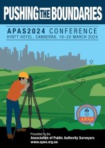
The 2024 annual conference of the Association of Public Authority Surveyors, NSW (APAS) will be held at the Hyatt Hotel, Canberra, from 18 to 20 March 2024. The theme of the conference will be ‘Pushing the Boundaries’.
The Call for Abstracts is now open, with the following deadlines set:
- Abstract submission deadline: Friday, 22 September 2023
- Draft paper deadline: Friday, 17 November 2023
- Final paper deadline: Friday, 19 January 2024
The 2024 NSW Geospatial Excellence Awards will recognise individuals, teams and organisations that have made significant contributions to the field of geospatial technology and applications.
The awards highlight excellence in various categories, including research, project implementation and technological advancements.


