Featuring Don Murray, Co-Founder and President at Safe Software. With over 30 years experience and a Masters Degree in Computer Science from Simon Fraser University, Don leads the direction of Safe and focuses his specialty on server and cloud-based solutions. He regularly travels around the world sharing his passion for making data integration accessible to everyone who needs it.
With only a limited number of seats available, don’t miss this opportunity to find out where it’s come from and what the future holds!
“Supported by SSSI and SIBA/GITA”

SSSI in conjunction with the Hunter Environmental Institute will present this webinar with three pre-eminent speakers:
Amy Steiger (Cardno)
Title: RPAS and thermal cameras for wildlife detection post-bushfire and coastal monitoring
Details: Amy has promoted the use of Remotely Piloted Aircraft Systems (RPAS) gaining experience with remote data capture to cover a range of coastal, environmental and land development applications.
RPAS thermal inspection capability was deployed this summer in wildlife detection post-bushfires.
Amy has also done volumetric surveys of beaches and flown isolated coastal cliff faces in NSW to capture high-resolution photography and derived photogrammetric models to identify geotechnical hazards and contribute to coastal monitoring.
Charity Mundava (WaterNSW)
Title: Remote Sensing in Water Management
Details: Charity will discuss the use of GIS and remote sensing to support water catchment management, feasibility and environmental studies for critical water infrastructure across the state and to support ongoing research into and management of river catchments. Charity will touch on the significance and spatial support for this in the recent NSW bushfires coordinating reservoir availability (in drought) and access for helicopter water drops and supporting bushfire fighting efforts.
Associate Professor In-Young Yeo (University of Newcastle)
Title: Remote sensing and GIS applications for water resources management
Details: Dr Yeo will explain how remote sensing can be used as a technique for assessing soil moisture using multi-source data fusion approaches, vegetation monitoring and water requirement with remote sensing and water balance approach.
She will explain the impacts of conservation management practices in agricultural catchments assessed using catchment model and remote sensing/GIS drawing on examples from Australian and American case studies
CPD Points
BOSSI CPD is 1 SP for this webinar.
Cost
As per details as follows
Contact
rom.nsw@sssi.org.au

Hosted by 12d – the companies behind 12d Model and 12d Synergy – the highly anticipated 12d Tech Forum returns on 19 – 21 October 2021. The three-day online industry summit will connect over 2,000 surveying, engineering, and construction professionals to learn, innovate, and be inspired.
The 12d Tech Forum provides surveying and geospatial professionals with an excellent training opportunity to keep up to date with the latest innovations and advancements in the industry.
50+ Hours of Inspiring Industry Talks
The 12d Tech Forum will host over 50 hours of industry insights, case studies from cutting-edge Australian and New Zealand surveying projects, and actionable training content. Delivered by some of the greatest minds and speakers in the industry. Talks are tailored for surveyors, engineers, and directors, not just 12d operators.
Free Access to All Keynote Presentations
We’ve secured a huge line-up of 40+ industry speakers, including talks from Land Surveys, Fulton Hogan, GHD, SMEC, Piritahi, and many more.
A few keynote titles include:
- Pilbara Desert Collaboration: Land Surveys’ data management strategy collaborating across the Pilbara desert
- GDA2020 at Mackay City Council: Practical insights into successfully implementing GDA2020 through 12d Model
- Piritahi Case Study: 10,000 lot land development project to crush the Auckland housing crisis
- TfNSW Steering Group & Uniform Coding: Aligning managed utilities through a consistent framework for delivery
Best yet, all sessions will be recorded and available to watch on-demand for 12 months after the event.
Surveying and Geospatial Topics Include…
- BIM & Digital Engineering
- Land & Construction Surveying
- GDA2020, ADAC, A-SPEC
- Point Clouds
- Drone Surveying & Photogrammetry
- Mobile Mapping & GIS
- Digital Twins & Asset Management
- Data Management & Collaboration
Check Out the Preliminary Event Agenda
To see a comprehensive list of keynotes and topics that will be covered at the 12d Tech Forum 2021, check out our Preliminary Event Agenda here.
12d Training Breakout Streams
For more tailored training content focused on upskilling your use of 12d software, purchase a Training Pass (A$149 +GST). Here you will have access to an additional five technical streams covering topics on Design, Survey, Water, Data Management, and Training.
Accrue CPD Points
Every hour you watch of the 12d Tech Forum can earn you 1 CPD point for many industry institutions, such as SSI, Australian Consulting Surveyors, Engineers Australia, and many more.
Virtual Networking Sessions
Meet like-minded individuals and build lasting relationships with our virtual networking sessions. The online forum will be attended by thousands of surveying, mapping, and geospatial professionals from across Australia, New Zealand, and abroad.
Register for FREE Today
Join over 2,000 professionals and gain access to 50+ hours with 150+ in-depth talks, delivered by over 60 speakers. Register for your free Industry Pass today!
To learn more and register, visit 12dtechforum.com/

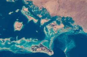
During GEO Week 2021, the Group on Earth Observations will present the multidisciplinary activities of the GEO Work Programme that address policy agendas involved in the UN Framework Convention on Climate Change (UNFCCC) COP26, the Convention on Biological Diversity (CBD) COP15, the UN Decade of Ocean Science for Sustainable Development and the UN Decade of Ecosystem Restoration.
The online event will include the GEO-17 plenary, plus anchor and side events. Time will be scheduled each day for virtual networking. On Monday, November 22, the 56th Executive Committee will be held as a closed meeting.
Of particular importance will be the anchor events: These are the main events designed by GEO week 2021 organisers to explain the multidisciplinary nature of GEO through the concept of nexus thinking. Working on multiple topics simultaneously is essential in today’s rapidly changing environmental and social conditions. For example, work in one area will have a knock-on effect or impact in another area, such as the water, energy and food nexus. These events are linked to the global policy agendas that underpin most of GEO’s work.
Image credit: NASA

The 2022 SSSI Queensland Regional Conference will be held on Friday, 14 October at the Brisbane Convention & Exhibition Centre. It promises to once again be a fantastic opportunity to learn and connect with SSSI members and the broader surveying and spatial community.
The Queensland Asia-Pacific Spatial Excellence Awards dinner will also be held in conjunction with the conference, celebrating the outstanding work being undertaken across the region.
Image credit: ©stock.adobe.com/au/rudi1976

The Geospatial Council of Australia’s 2023 North Queensland Conference will be held at the Cairns Colonial Club on 28 August 2023.
This annual conference is an opportunity for local surveying professionals at all levels to get together to hear about local projects, connect with colleagues old and new and see the latest equipment from suppliers.
The full conference program is now available.
Image credit: ©stock.adobe.com/au/Gorodenkoff

The 2023 Queensland Geospatial Conference & Awards Dinner will be held in Brisbane on Friday, 20 October 2023.
The conference will be a chance for the Queensland geospatial community to learn about the latest projects and research, connect with colleagues and see the latest technology from local suppliers. The conference will be followed by the awards dinner.
Presentation abstract proposals are being accepted until Monday, 28 August.
Image credit: ©stock.adobe.com/au/rudi1976

The 2024 Queensland Geospatial Conference will be a dive deep into the latest technologies, trends, and best practices shaping the geospatial sector in Australia. The event will give professionals ranging from GIS specialists to remote sensing experts the chance to gain valuable insights and forge new partnerships.
The event will conclude with the 2024 Queensland Geospatial Excellence Awards ceremony, which will celebrate achievements and innovations by individuals and organisations within Queensland’s geospatial sector.


