


The ITS Australia Summit 2022 in Brisbane will feature a strong industry program over three days driven by abstract submissions & invited keynote presentations, and will include technical tours & demonstrations, cutting edge industry exhibition, workshops, panel discussions, and an exciting social program.
As Australia’s leading transport technology event, Summit will demonstrate new insights and initiatives that will determine our path toward an accessible and automated future transport network.

Since the establishment of Scott Base on Ross Island by the late Sir Edmund Hillary in 1957, surveyors have been appointed to assist scientists with survey related tasks on the ice.
This presentation by a panel of Antarctic surveyors promises to be educational, entertaining and informative, as they talk about their experiences on projects on the frozen continent over the last 35-plus years.
Image credit: ©stock.adobe.com/au/hrathke

Each year representatives from the Association of Consulting Surveyors NSW and the Institution of Surveyors NSW come together to organise the NSW Excellence in Surveying and Spatial Information (EISSI) Awards.
The awards recognise the achievements of organisations and individuals from across the state who are engaged in the surveying and spatial information profession; celebrate excellence before an audience of industry peers; encourage activities that create a stronger, larger and more relevant industry; and embrace the achievements of the industry and its related industries and professions.

Featuring a spotlight on crowd-sourced bathymetry, the Map the Gaps Symposium 2023 will bring people together to learn, share and contribute to ocean discovery.
Held on behalf of GEBCO, this event draws global experts in ocean technology, science and policy to discuss deep and coastal ocean exploration, offshore surveying technology, policy, diversity, equity and inclusion, the Nippon Foundation-GEBCO Seabed 2030 project and GEBCO alumni activities.
Participation is open to all, including industry professionals, explorers, authors, students, researchers, government representatives and emerging technologists. Participants can attend in person or online.

Hosted by the Riverina Eastern Regional Organisation of Councils and the Riverina Spatial Information Group, Mapped Out 2023 will bring together public- and private-sector professionals to learn about the latest geospatial developments.
Mapped Out will highlight the diversity of applications for spatial data, geographic information systems and their supporting technologies. Guest speakers with local and national experience will be showcasing the use of spatial data to enhance the operation and delivery of government services.
The Conference is a great opportunity for people working in regional NSW in both local government and the private sector to keep abreast of the latest technology and geographical information systems that can be utilised in their day-to-day work.

The 2024 edition of the International Conference on Geographical Information Systems Theory, Applications and Management (GISTAM 2024) aims to create a meeting point of researchers and practitioners that address new challenges in geo-spatial data sensing, observation, representation, processing, visualization, sharing and managing, in all aspects concerning both ICT as well as management information systems and knowledge-based systems.
The conference welcomes original papers of either practical or theoretical nature, presenting research or applications, of specialised or interdisciplinary nature, addressing any aspect of geographic information systems and technologies, such as:
- Data acquisition and processing
- Remote sensing
- Interaction with spatial-temporal information
- Spatial data mining
- Managing spatial data
- Modelling, representation and visualisation
- GIS and climate change
- Domain applications
The ROTORTECH Helicopter and Uncrewed Flight Exposition is the premier industry event for the Helicopter/Rotary Wing and RPAS/UAV/eVTOL community in Australia, New Zealand and the Indo-Asia-Pacific region.
Held by AMDA Foundation with input from major industry supporter the Australian Helicopter Industry Association, ROTORTECH 2024 will provide a vital interface between industry, regulators and government, including:
- Operations and safety presentations
- Industry conferences
- Manufacturers technical workshops
- Industry exposition showcasing the products and services of helicopter and uncrewed flight related companies
ROTORTECH 2024 will host conferences by the AHIA and Australian Association for Uncrewed Systems (AAUS) and feature presentations by key rotary and uncrewed flight industry experts from Australia and the Indo-Asia-Pacific region.
The 12d Tech Forum offers:
- A great opportunity to develop your 12d Model/12d Synergy skills
- The ability to interact with the developers of 12d products
- The chance to network with, and learn from, other 12d users
- The 12d Innovation Awards 2024 Ceremony.
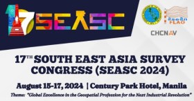
The 17th South East Asia Survey Congress (SEASC 2024) is a premier gathering of geodetic engineers, professionals and experts from across Southeast Asia. This year’s event will be held in the Philippines, a nation rich in geographical diversity and a hub for geospatial and geomatics advancements.
Themed ‘Global Excellence in the Geospatial Profession for the Next Industrial Revolution,’ SEASC 2024 promises to be an intellectually stimulating and enriching experience, bringing together experts to share their knowledge, insights, and innovations in the wide-ranging fields of geodesy, geospatial science and geomatics.
In recognition of the needs of the global community, SEASC 2024 will be conducted in a hybrid format to ensure inclusivity and accessibility, allowing both in-person and online attendees to participate fully.

The Centre for Spatial Data Infrastructures and Land Administration (CSDILA) at the University of Melbourne, will host the Global Geospatial and Land Community at Melbourne Connect.
The program will include a Certified Leadership Training Course, which will equip executives and leaders with the knowledge, skills and insights needed to leverage geospatial technologies effectively, drive innovation within their organisations, and respond proactively to the evolving landscape of geospatial challenges and opportunities.
The associated Global Forum on Advancing Land and Geospatial Knowledge and Innovation will see the CSDILA and UN-GGIM bring together a leading team to deliver specialised leadership training in the domains of geospatial data and land administration.
Image credit: ©stock.adobe.com/au/Artofinnovation
