Check out our upcoming Webinar which talks more about the Growing Data Foundation’s FireWater App and the SSSI FireWater Map-a-thon. Details are as follows:
Date: Wed, 7th October, 2020
Time: 12PM AEDT
RSVP: Further details click here
And don’t forget to register for the SSSI FireWater Map-a-thon here

The previous Map-a-thon focused on bushfire recovery; this Map-a-thon focuses on bushfire preparedness. During bushfires, firefighters often have difficulty sourcing water. In some regional locations mains water may not be accessible to fight a major bushfire. Static water supplies, such as swimming pools, tanks and dams, are vital sources of water for firefighters. This map-a-thon seeks to map swimming pools, tanks and dams to update Australia’s Static Water Supply System.
The focus area for this Map-a-thon is Kangaroo Island and regional Victoria.
NGIS Australia will be setting up the project sites and will put all the systems in place to make sure the map-a-thon runs as smoothly as before. Nearmap will generously supply high resolution aerial imagery where available. As mentioned previously, the OpenStreetMap (OSM) Platform and Hot Tasker Manager will be used to coordinate the mapping effort.
No matter where you are in the world, you can participate in the SSSI FireWater Map-a-thon. We encourage all participants to register here so you are kept up to date on news, important information such as the training manual and links to the project sites (which will be sent to participants a day prior to the Map-a-thon).
The Map-a-thon will commence at 10am AEDT and will run for 24 hours, to take in to account all time zones. Participate for as long as you like during the 24hrs – there are no time restrictions.
We are pleased to announce that SSSI will this year be partnering with SIBA|GITA and DELWP to present the 2020 Victorian Spatial Showcase & eSummit.
This will be held as a special online event over two days in November.
Join us as we bring together government agencies, industry academics and community spatial enthusiasts to connect and learn more about the innovative spatial data, technology and services that Victoria has to offer. On the agenda is a mix of lightning talks and presentations by a diverse range of industry professionals, interactive sessions, networking opportunities and more.
The event is also aligned with World GIS Day, taking place on Wednesday 18 November. GIS Day is a day to help others learn about geography and the real-world applications of GIS that are making a difference in our society, so we hope this event is an apt way for our local GIS heroes to celebrate their day!
Spatially enabling the Sustainable Development Goals
This year, we’re going to tackle some of the world’s most complex problems – our 2020 theme is exploring how the spatial industry is enabling the United Nations Sustainable Development Goals (SDGs) through innovation. But what are the SDGs you might ask? The 2030 agenda for Sustainable Development, adopted by all UN Member States in 2015. provides a shared blueprint for peace and prosperity for people and the planet, now and into the future. At its heart are the 17 Sustainable Development Goals (SDGs), which are an urgent call to action by developed and developing countries across the globe.
During the eSummit, the Victorian spatial community will draw on its collective experience to identify opportunities and challenges for us all to achieve these goals.
Program
The full program for the event is now available here!
Please note this is subject to change.
The format
The event will be held from 9.00am – 12.30pm over two days on 18 – 19 November 2020, using Zoom software. You’ll receive links to the sessions closer to the event.
If you can’t make the live event, make sure you still register below and you will be sent the link to the recordings to watch at your leisure.
Young Professionals eNetworking
Just because the event is online this year doesn’t mean that you can’t get involved in the networking! Grab a drink of your choice and come along to the Showcase & eSummit networking evening, hosted by the SSSI Young Professionals at 4pm on the first day of the event, Wednesday 18 November.
It’s a structured networking evening involving small group conversations where you’ll get to meet new people or catch up with industry colleagues that you haven’t seen for a while discussing the topics of the night.
The event is open to all – register now to attend!
Registration Fees
In recognition of current circumstances, we are very pleased to announce that registration for this two day event will be FREE for all to attend.
Please only choose Full Event (access to both days) OR choose Day One only or Day Two only.
CPD Points
- SSSI CPD Points: 3 per day
- FPET (Vic) Points: tba
- BOSSI (NSW) Points: tba
- LSLB (WA): 4 General points and 1 Cadastral Point
- LSE (Tas) Points: Day 1 – 3.0 General Education; Day 2 – 1.5 Land Surveying Education, 2.0 General Education
Only the individual registered is entitled to claim the associated CPD points.
Sponsorship
Do you have a product or service you would like to promote to our diverse and relevant attendees? Consider supporting the 2020 Victoria Spatial Showcase & eSummit and receive a great range of marketing benefits. Click here to view the sponsorship proposal or contact Katie on the details below.
Thanks to our fantastic Gold Event Sponsors!
Contact
Katie Le Miere
SSSI National Events Manager
katie.lemiere@sssi.org.au

Are you a young surveyor and always wondered what the digital frontier of the profession looked like? Are you mid career but developed foundation skills but have not yet ventured into the digital data part of the discipline? Are you a seasoned professional who loves to see what amazing things you can do with the tools and technologies of the 21st century?
If you answered yes to any of those questions then this is a webinar you won’t want to miss!
Michael Finlay is a Geospatial Engineer who specialises in 3D laser scanning and point cloud technologies. He is an early career professional who has been working at Jacobs for 8 years and is passionate about all things 3D laser scanning, especially mobile laser scanning (MLS). Michael is a trail blazer in developing the digital data team and discipline at Jacobs as not only a real value add, efficiency but product and service enricher for the surveying team. He gets involved with the planning, scanning, processing, adjusting, classifying, extracting, automation, analysis, visualisation and supports the interfaces of surveying and digital engineering and GIS environments for stakeholders from a broad variety of disciplines.
Check out Michael’s profile to see some of the amazing projects he has been involved in and how he champions this modern digital space for surveying and geospatial engineers.
Registration
By registering below, you receive access to the watch the webinar live OR if you can’t watch it live, you receive the link to the recording 24 hours after the event date. You can then watch the recording at your leisure.
CPD
This event is worth one SSSI CPD Point. BOSSI points to be confirmed.
Note, only the individual registered for the event is entitled to receive the associated CPD points.
Contact
Katie Le Miere, National Events Manager
katie.lemiere@sssi.org.au

Update: This event has been rescheduled from its original date of 24 February.
The SSSI 2021 Victorian Surveying & Spatial Summit will be an opportunity for all Victorian surveying and spatial professionals to come together to learn, share and connect. The theme will be ‘Digital Transformation: Our Future’.
The one-day event will take place at the Novotel on Collins, Melbourne, and will be followed in the evening by the presentation of the Victorian Asia-Pacific Spatial Excellence Awards — the Awards celebrate the outstanding work being undertaken by individuals and organisations in the region.
Discounts are available for SSSI members and students. You can choose to register just for the Summit or select full registration which includes a ticket to APSEA-V event as well. Tickets for APSEA-V only (individual or full table of 8) are also available.
There will also be a pre-summit breakfast on the topic of Diversity and Inclusion, and organisers encourage potential participants to consider purchasing a ticket when registering for the Summit.

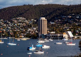
The 2022 Tasmania Surveying & Spatial Conference will be held on Friday, 2 September at Wrest Point in Hobart, and promises to be a fantastic opportunity to learn and network with SSSI members and the broader surveying and spatial community.
This year’s event will include a gala dinner, held in partnership with the University of Tasmania, to celebrate that institution’s 50 years in the field of surveying and spatial teaching.
In addition, the event will include the presentation of the 2022 Tasmanian Asia-Pacific Spatial Excellence Awards.
Image credit: ©stock.adobe.com/au/Norman

The 2022 SSSI Queensland Regional Conference will be held on Friday, 14 October at the Brisbane Convention & Exhibition Centre. It promises to once again be a fantastic opportunity to learn and connect with SSSI members and the broader surveying and spatial community.
The Queensland Asia-Pacific Spatial Excellence Awards dinner will also be held in conjunction with the conference, celebrating the outstanding work being undertaken across the region.
Image credit: ©stock.adobe.com/au/rudi1976

The 2022 SSSI Victorian Surveying & Spatial Summit and APSEA-V Dinner will take place on Thursday, 27 October 2022. It will be an opportunity for all Victorian surveying and spatial professionals to come together to learn, share and connect.
The event will feature an array of speakers, along with plenty of networking opportunities and the chance to see the latest products and services from local suppliers.
Image credit: ©stock.adobe.com/au/Wirestock

The 2022 SSSI NSW Regional Conference will be held on Thursday 10 November and Friday 11 November 2022 at the Novotel Sydney Central. The theme will be ‘Connections’.
This regular event is an opportunity to learn from and connect with other SSSI members and the broader geospatial community.
The first day will comprise the main conference, with speakers presenting on various topics, followed by the NSW & ACT Asia-Pacific Spatial Excellence Awards dinner in the evening.
The second day will be a NSW Spatial Digital Twin workshop, an interactive session that will get ‘under the bonnet,’ looking at data sharing, use cases and more.
The Call for Abstracts will close at midday on Monday, 26 September 2022. Abstract proposals can be submitted online at https://lnkd.in/ek4xS6Bu.
The organisers are seeking papers and presentations on a variety of topics, such as:
- technical innovation, spatial aps, cloud computing, survey innovation, RPAS
- data analytics, crowd sourcing, machine learning, artificial intelligence, automation, data partnerships
- surveying -—land, cadastral, hydrographic, aerial survey, engineering
- 3D, digital engineering, LiDAR, reality meshes, BIM
- mobility, emergency management, spatial digital twins, environment, community, smart cities, utilities, coastal management, climate change
- convergence of space and spatial
Registrations are now open online for the conference, dinner and workshop at https://lnkd.in/eVSxGWeB.
The event’s Principal and Major sponsors are the NSW Department of Customer Services–Spatial Services and TAFE NSW.

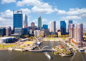
The Geospatial Council of Australia’s Western Australia Digital Twin Summit will be held on 15 November 2023.
The event will focus on Spatial Digital Twins, and attendees will hear the latest developments in this rapidly developing space from government, academia and private industry presenters.
The WA Asia-Pacific Spatial Excellence Awards dinner will also be held in conjunction with the conference, celebrating the outstanding work being undertaken across the region.
Image credit: ©stock.adobe.com/au/anekoho


