
Hosted by the Riverina Eastern Regional Organisation of Councils and the Riverina Spatial Information Group, Mapped Out 2023 will bring together public- and private-sector professionals to learn about the latest geospatial developments.
Mapped Out will highlight the diversity of applications for spatial data, geographic information systems and their supporting technologies. Guest speakers with local and national experience will be showcasing the use of spatial data to enhance the operation and delivery of government services.
The Conference is a great opportunity for people working in regional NSW in both local government and the private sector to keep abreast of the latest technology and geographical information systems that can be utilised in their day-to-day work.

The annual Geo Connect Asia Show & Conferences offers a two day, in-person meeting place for ASEAN’s vibrant geospatial community. Bringing geospatial solutions to the heart of decision-making the event combines with technologies from the digital construction, drone and remote sensing markets.
Geo Connect Asia looks to host its ASEAN neighbours and build on a vibrant community as new technologies add new application tools to enable the Industry 4.0 Revolution. The emergence of AI, blockchain, IoT, robotics and UAVs create a new dynamic and platforms for a region well equipped to take on the challenges ahead.

The not-to-be-missed Geospatial Council of Australia (GCA) South Australia Cadastral Workshop, to be held in Adelaide on 16 March, will bring together professionals in the field of land surveying and provide an opportunity for them to expand their knowledge of the complexities of cadastral surveying.
This workshop offers a unique opportunity for professionals in the field of land surveying to gather and expand their knowledge in the complexities of cadastral surveying. Participants will hear expert-led discussions into topics ranging from advanced surveying techniques to legal frameworks governing land boundaries, and gain invaluable insights to enhance their expertise and address the challenges of modern cadastral surveying practices.
- Members: $90 (incl. GST)
- Non-members: $135 (incl. GST)
- Registered survey graduates and students: $45 (incl. GST)

The Australian Institute of Mine Surveyors (AIMS) Mudgee Regional Seminar will be held at Parklands Resort, Mudgee, NSW, on 22 March 2024. There will also be an optional dinner at a local brewery the evening prior.
This annual event is always very well attended, and features presentations on a wide variety of mine surveying topics and technologies. You can read an account of the 2023 seminar on the AIMS website.

The 2024 edition of the International Conference on Geographical Information Systems Theory, Applications and Management (GISTAM 2024) aims to create a meeting point of researchers and practitioners that address new challenges in geo-spatial data sensing, observation, representation, processing, visualization, sharing and managing, in all aspects concerning both ICT as well as management information systems and knowledge-based systems.
The conference welcomes original papers of either practical or theoretical nature, presenting research or applications, of specialised or interdisciplinary nature, addressing any aspect of geographic information systems and technologies, such as:
- Data acquisition and processing
- Remote sensing
- Interaction with spatial-temporal information
- Spatial data mining
- Managing spatial data
- Modelling, representation and visualisation
- GIS and climate change
- Domain applications

The ROTORTECH Helicopter and Uncrewed Flight Exposition is the premier industry event for the Helicopter/Rotary Wing and RPAS/UAV/eVTOL community in Australia, New Zealand and the Indo-Asia-Pacific region.
Held by AMDA Foundation with input from major industry supporter the Australian Helicopter Industry Association, ROTORTECH 2024 will provide a vital interface between industry, regulators and government, including:
- Operations and safety presentations
- Industry conferences
- Manufacturers technical workshops
- Industry exposition showcasing the products and services of helicopter and uncrewed flight related companies
ROTORTECH 2024 will host conferences by the AHIA and Australian Association for Uncrewed Systems (AAUS) and feature presentations by key rotary and uncrewed flight industry experts from Australia and the Indo-Asia-Pacific region.
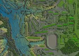
The Philippines will host the International Society for Photogrammetry and Remote Sensing (ISPRS) Technical Commission V (TC V) Symposium with the theme, ‘Insight to Foresight via Geospatial Technologies,’ from 6 to 8 August 2024 in Manila.
The three-day event will feature plenary and parallel sessions, exhibits, poster presentations and business meetings, and aims to inspire new methods of teaching/learning, collaboration, and promotion of accessible and easy-to-use geospatial data among engage professionals, educators and tertiary students.
ISPRS TC V focuses on the capacity building of professionals, educators and students, and in developing cost-effective teaching methods. These include distance learning programs, international collaborations on sharing web-based resources, and curricula development that meets regional needs.
- Deadline for submission of full papers for annals & abstracts for archives: 15 March 2024
- Notification of paper acceptance: 15 April 2024
- Early registration: 15 May 2024
Image credit: ©stock.adobe.com/au/Ungrim
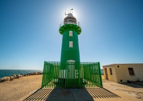
The international photogrammetry and remote sensing community will gather in Perth in October 2024 for the mid-term symposium of the International Society for Photogrammetry and Remote Sensing (ISPRS) Technical Commission IV: Spatial Information Science.
The ISPRS is a non-governmental organisation devoted to the development of international cooperation for the advancement of photogrammetry and remote sensing and their applications.
The Geospatial Council of Australia is the Australian member of ISPRS, with Australia’s Professor Sisi Zlatanova appointed Chair of ISPRS Technical Commission IV.
The symposium will provide a forum for researchers and practitioners to come together and share their work and ideas, discuss opportunities and challenges, exchange developments or software tools, and discuss future directions.
Image credit: ©stock.adobe.com/au/Luciano Raspa/Wirestock Creators

The Centre for Spatial Data Infrastructures and Land Administration (CSDILA) at the University of Melbourne, will host the Global Geospatial and Land Community at Melbourne Connect.
The program will include a Certified Leadership Training Course, which will equip executives and leaders with the knowledge, skills and insights needed to leverage geospatial technologies effectively, drive innovation within their organisations, and respond proactively to the evolving landscape of geospatial challenges and opportunities.
The associated Global Forum on Advancing Land and Geospatial Knowledge and Innovation will see the CSDILA and UN-GGIM bring together a leading team to deliver specialised leadership training in the domains of geospatial data and land administration.
Image credit: ©stock.adobe.com/au/Artofinnovation

The Geo Connect Asia Show and Conference has scaled up from its launch in 2020 to become the regional meeting place for the fast expanding geospatial, positioning, digital construction and remote sensing markets.
With the growing application of geospatial based knowhow in decision-making across government, enterprise and non-profit the annual event comprises a show with a mix of thought leadership and technical platforms.
Last year’s event attracted more than 100 leading companies and 2494 visitors. Its co-location with Drones & Uncrewed Asia both presents the global UAV industries, but also addresses the importance of data acquisition and analytics in critical and emerging vertical markets.
Digital Construction Asia adds particular focus on the development of one of the region’s largest industries.
The addition of Marine & Hydro Asia expands the reach into the region’s hydro-marine data markets, which are so critical to the economy and security of Southeast Asia.


