Featuring a spotlight on crowd-sourced bathymetry, the Map the Gaps Symposium 2023 will bring people together to learn, share and contribute to ocean discovery.
Held on behalf of GEBCO, this event draws global experts in ocean technology, science and policy to discuss deep and coastal ocean exploration, offshore surveying technology, policy, diversity, equity and inclusion, the Nippon Foundation-GEBCO Seabed 2030 project and GEBCO alumni activities.
Participation is open to all, including industry professionals, explorers, authors, students, researchers, government representatives and emerging technologists. Participants can attend in person or online.

The Tasmanian Spatial Information Council (TASSIC) will hold a Geospatial Workforce Development Forum on 9 November 2023, to help shape the future of the geospatial sector in Tasmania.
The Forum will bring together key stakeholders from education, employers, government and suppliers to address critical challenges and opportunities facing the sector.
The Forum will include presentations from representatives of industry, government and the education sector, as follows:
- Paul Digney (Jacobs)
- Rob Rowell (Insight GIS)
- Ben Morris (Local Government Association of Tasmania)
- Michael Krome (Australian Spatial Analytics)
- Arco Lucieer (University of Tasmania)
- Sam Ebert (TAFE NSW)
- Troy Robbins (TasTAFE)
The event will conclude with a moderated discussion session led by Danika Bakalich (Geospatial Council of Australia).
The Forum will be a hybrid event with both in-person and online attendance options available, and it will employ the Menti-Meter program to facilitate discussions, ensuring that each delegate’s voice is heard and their input valued.
Image credit: ©stock.adobe.com/au/borisblik

Hosted by the Riverina Eastern Regional Organisation of Councils and the Riverina Spatial Information Group, Mapped Out 2023 will bring together public- and private-sector professionals to learn about the latest geospatial developments.
Mapped Out will highlight the diversity of applications for spatial data, geographic information systems and their supporting technologies. Guest speakers with local and national experience will be showcasing the use of spatial data to enhance the operation and delivery of government services.
The Conference is a great opportunity for people working in regional NSW in both local government and the private sector to keep abreast of the latest technology and geographical information systems that can be utilised in their day-to-day work.

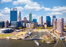
The Geospatial Council of Australia’s Western Australia Digital Twin Summit will be held on 15 November 2023.
The event will focus on Spatial Digital Twins, and attendees will hear the latest developments in this rapidly developing space from government, academia and private industry presenters.
The WA Asia-Pacific Spatial Excellence Awards dinner will also be held in conjunction with the conference, celebrating the outstanding work being undertaken across the region.
Image credit: ©stock.adobe.com/au/anekoho

The 2023 ACT Geospatial Conference and Excellence Awards will bring together colleagues old and new to hear the latest updates from across the local geospatial industry.
The call for abstracts for the event is now open. Any topic of interest to the geospatial industry is welcome, including surveying (cadastral, engineering, hydrographic, mining), GIS, remote sensing and geodesy, or broader topics such as new technology, diversity and workforce management.
The deadline for submission of abstract proposals closes at midday on Tuesday, 3 October.
The Geospatial Excellence Awards Reception will be held at the conclusion of the conference sessions, giving attendees the chance to enjoy drinks and canapes whilst networking and celebrating the award winners.
Image credit: ©stock.adobe.com/au/r-o-x-o-r

Hosted by Eric Andelin CP, Senior Workflow Specialist with guest speaker Michael O’Sullivan, VP Sales, SimActive Inc.
It is often challenging for new entrants into the aerial imagery and mapping service profession to determine cost savings when it comes to their processing software solution. Smaller sensors, altitude restrictions, line of sight requirements and overall flight duration create unique challenges for drone operators. Medium and large format sensors acquire much larger areas, but require a much larger investment, or the ability to subcontract out the acquisition. Mapping expenses tend to increase as projects become larger. And using the wrong image processing software can exacerbate this, leading to narrowing project profits. This webinar will show how a higher-end software such as SimActive’s Correlator3D™ can reduce overall project costs. REGISTER HERE.
Specifically, attendees will learn about the following:
- Common challenges and impact on costs
- Cost variations as projects increase in size
- Workflows in Correlator3D to minimize man-hours
- Accelerating timelines with distributed processing

The Andy Thomas Space Foundation is looking forward to welcoming a global audience to the 16th edition of the Australian Space Forum, to be held in Sydney on 6 December 2023.
This will be the first time the Forum will have been held in a city other than Adelaide; the organisers announced at the 15th Forum in May 2023 that from then on, every second Forum will be held in a city other than Adelaide.
The Forum provides an ideal opportunity to stimulate ideas, share information about emerging technologies and network with influential space sector leaders and the broader community.

GeoBuiz Summit is an annual international conference focused on the geospatial industry, which encompasses a range of technologies and applications related to mapping, location-based services, and spatial data analysis.
The summit brings together industry leaders, government representatives, experts, and innovators to discuss the latest trends and innovations in geospatial technology and applications.
The conference covers a range of topics, including geospatial infrastructure, mapping and surveying, satellite imagery and remote sensing, location-based services, smart cities and urban planning, and much more. The GeoBuiz Summit aims to promote collaboration and knowledge-sharing within the geospatial industry and to showcase the latest developments in this exciting and rapidly evolving field.

The Institute of Navigation’s (ION) mid-year meeting, the International Technical Meeting (ITM), is a conference with a technical program related to positioning, navigation and timing and includes the ION Fellows and Annual Awards presentations.
In 2024, ITM will take place in Long Beach, California, January 22 – 25, 2024, and will be co-located with the Precise Time and Time Interval Systems and Applications Meeting.
A commercial exhibition and pre-conference tutorials will be held in conjunction with the conference.

The Institute of Navigation’s (ION) annual Precise Time and Time Interval Systems and Applications (PTTI) meeting will take place in Long Beach, California, January 22-25, 2024, and will be co-located with the ION International Technical Meeting.
The PTTI technical program is designed to:
- Disseminate and coordinate PTTI information at the user level
- Review present and future PTTI requirements
- Inform government and industry engineers, technicians, and managers of precise time and frequency technology and its problems, and
- Provide an opportunity for an active exchange of new technology associated with PTTI.
A commercial exhibition and pre-conference tutorials will be held in conjunction with the conference.


