Spatial Solutions reports that the Galileo satellite has successfully ‘moved on’ and is now transmitting signals. After 17 really tough days and 11 complicated manoeuvres, the ESA’s scientists managed to deliver the satellite into the redesigned orbit, suitable for Navigation purposes.
How do you run a snowed-in underground railway? WNYC has created a fictional interactive map explaining how the New York subway system could survive a future ‘snowmaggedon’. On 26th January, the subway system was completely closed because of a snowstorm.
A mini space plane is about to go on a suborbital jaunt. Next month, the European Space Agency will launch a space plane the size of a small car into a suborbital trajectory to test its autonomous re-entry capabilities. The IXV (Intermediate eXperimental Vehicle) will take off on top of a rocket in French Guiana, fly over most of Europe and Asia, re-enter the atmosphere, and if all goes well, splash down somewhere in the South Pacific.
There is a new map game around: type any word in any language into Wordmap, and you can listen to it being translated into every other language in the world. After you type a word into Wordmap a Google Map is slowly populated with all of the word’s translations. As the translated word is added to each country on the map you can also hear the translated word being pronounced in each language.
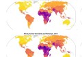
And finally if you want to see real-time CO2 emissions, SkyTruth has updated its map of Global Flaring. This map shows a heat map of nightly, infrared satellite detections of natural gas flaring across the Earth.
For cost reasons oil producers frequently flare methane and other gases produced by oil wells rather than recover the gases. This flaring adds huge amounts of CO2 to the atmosphere and the gases themselves can often pollute the air.