A new mapping and surveying company, Austech Surveying and Mapping (ASM), has launched in Australia.
According to a media release from the company, ASM is an Australian Company ‘committed to providing leading edge geospatial data acquisition, mapping and survey solutions to a wide range of industry sectors including mining, quarry, and construction throughout Australia, New Zealand and South East Asia.’
Some of the services provided by Austech Surveying & Mapping include:
- Cavity and void monitoring, Ore pass monitoring and Stope Surveys, limited & hazardous access surveys for open cut and underground mines
- Abandoned and recovery mine surveying
- 3D rock face profiling and Blast design surveys in Quarries,
- Stockpile/ Volumetric surveys
- Engineering and Construction Surveys
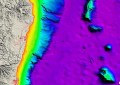
- Coast, Ports & Harbours and Mapping
“Safety is a number one focus; we play a key role in redefining safety, productivity and risk management in mining operations,” said Julia Reynolds, general manager of ASM.
“We have developed a highly qualified and experienced team with 40 years of experience in mine surveying, subsurface investigation, quarry rock-face profiling, 3D laser Scanning, LiDAR, and Hydrographic Surveys.”
“At ASM we are dedicated to building long-term working relationships. Our experienced staff are involved in the most complex and challenging projects worldwide including: Newcrest, Newmont, Solid Energy NZ, Pike River, Bluestone and more,” said Reynolds.