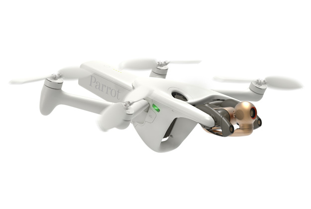
Parrot has announced the ANAFI Ai, which it claims is the first drone to use 4G as the main data link between the drone and the operator, enabling control at any distance.
A 48MP main camera and a stabilised 4K 60fps/HDR10 camera (14 EV of dynamic range) enables the capture of finely-detailed images and smooth video footage; the 6x digital zoom can pick out 1 cm details at a distance of 75 m. Parrot says the quad Bayer 48MP sensor delivers survey-grade accurate 2D and 3D models while offering the same precision as drones with a 1-inch 20MP sensor, while flying 1.5 times higher. A GSD of 0.46 cm/pixel is obtained at an altitude of 30 m, and pictures can be captured at 1fps.
The controllable gimbal tilt range (from -90° to +90°) enables access to complex points of view such as the underside of a bridge, while hybrid image stabilisation on 6 axes (3-axis mechanical, 3-axis electronic) provides sharp images in crosswinds of up to 12.7 m/s.
ANAFI Ai’s obstacle-avoidance system uses stereo cameras to sense objects in all directions and automatically avoid them. Embedded AI enables photogrammetry-specific flight plans to be performed automatically; users can generate optimised missions based on the land registry of the building selected with just one click.