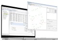
DCS Spatial Services is seeking industry feedback on its Collaboration Portal and future imagery and elevation products.
The NSW agency wants to hear from current customers and the wider geospatial community, on how easy or hard it is to use the Collaboration Portal to find the required datasets, interpret search results and work out which datasets meet the user’s requirements.
It also wants to hear from users on whether or not they use the export function, and whether it might be improved.
You can take part in the ‘Dataset Discoverability’ survey here.
Similarly, DCS Spatial Services wants to hear from users or potential users of its aerial imagery, LiDAR and elevation products, and in particular get their feedback on proposed future product types.
For instance, some of the proposed imagery and elevation-related product types under consideration are:
- Digital surface models
- Digital height models
- Building outlines
- Solar reflective index (per building)
- Distance from coastline (environmental risk)
- Terrain slope and aspect maps
- Line-of-sight and visibility analysis
- 3D building models and city meshes
The ‘Imagery and Elevation products proposals’ survey can be found here.