Badan Informasi Geospasial, Indonesia’s geospatial information agency, has launched the Piksel sovereign Earth observation analysis platform.
Developed with support from Geoscience Australia, the goal of Piksel is to strengthen Indonesia’s ability to map, monitor and sustainably manage its environment and natural resources.
The platform aims to integrate the remote sensing data processing and analysis needed to address the need for large-scale satellite imagery utilisation.

Acknowledging the realities of satellite-derived Earth observation utilisation, the Acting Head of Badan Informasi Geospasial (BIG), Mohamad Arief Syafi’i, said “The challenge lies not merely in acquiring the data. The far greater challenge is processing such vast amounts of data into useful information quickly, efficiently, and in a way that makes it accessible to a broader range of stakeholders.”
Already, the platform has been put to use in a variety of ways for identifying flood-affected areas, detecting coastline changes, monitoring of rice planting areas, calculating mining areas, classifying mangrove regions, and monitoring surface temperatures around geothermal power plants.
Freely available data and services
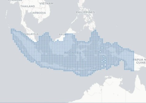
The Piksel platform currently provides access to 50 TB of data covering the entire territory of Indonesia. All of that data is available openly and freely via APIs.
The data archive includes information from the Sentinel-1, Sentinel-2, and Landsat 5, 7, 8 and 9 missions.
Piksel currently provides six different services:
- A Data Explorer that enables uses to browse the metadata catalogue and check imagery availability by location and date;
- An Interactive Map that enables users to view imagery products and datasets;
- The Piksel Sandbox, which uses JupyterLab and Open Data Cube for exploring data and developing Python analyses;
- Geospatial Data Processing, which can run large-scale geospatial processing with cloud computing and Argo Workflows;
- Web Services that connect QGIS, ArcGIS or other applications through OGC services such as WMS, WMTS and WCS; and
- A Support and Collaboration service through which users can access help, training and information from the Piksel team.
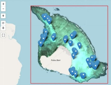
Piksel data products are organised into the following groups:
Baseline satellite data — per-scene products and temporal composites from several missions:
- Surface Reflectance from Landsat 5, 7, 8 and 9, and Sentinel-2.
- Surface Temperature from Landsat 5, 7, 8 and 9.
- Radar Backscatter from Sentinel-1.
- Annual GeoMAD composites from Sentinel-2.
Marine and coastal data — derived products such as Ina Coastline for analysing shoreline change.
Piksel collaboration for maritime matters
The Australia-Indonesia collaboration at the heart of the launch of Piksel reflects the growing natural maritime partnership between the countries.
The two nations are working together to support Indonesia’s coastal communities, promote a sustainable blue economy, and address shared challenges in marine resource management.
“Piksel will allow Indonesian officials and researchers to perform national scale analysis of the environment to produce impactful and cost-efficient mapping products from satellite imagery,” said Lauren Power, A/g Oceans, Reefs, Coasts and the Antarctic Branch Head, Geoscience Australia.
“Piksel can be used to develop coastal and marine mapping products such as Ina Coastlines that provide the foundational geospatial data required for effective marine resource management and marine spatial planning.”
Assistance from Australia
In the lead up to the official launch of Piksel, experts from both countries came together earlier this year for a five-day Technical Earth Observation Workshop at the University of Sydney.
The workshop was held from 9 to 13 February and saw Digital Earth Australia developers from Geoscience Australia meet with their Indonesian counterparts under the auspices of a memorandum of understanding signed in 2025 between BIG and Geoscience Australia within the framework of the two nations’ Marine Resources Initiative.
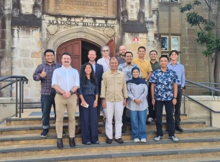
The event was attended by seven staff from BIG’s Directorate of Thematic Mapping and the Directorate of Marine and Coastal Topographic Mapping. The University acted as the training facilitator and host.
The hands-on event used the Piksel platform to produce two main products: cloud-free GeoMAD imagery of Indonesia from Sentinel-2 data and multi-year Landsat-based coastline data.
The results will provide an important foundation for the development of other derivatives, such as land cover maps and natural disaster analysis.