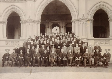
LINZ has celebrated 150 years since the formation of the Department of Lands and Survey, its earliest predecessor agency.
By Sam Anderson
As one of New Zealand’s oldest government departments, Toitū Te Whenua Land Information New Zealand (LINZ) has achieved a lot over the years.
The Department of Lands and Survey officially started on 1 May 1876, following the assumption of power by central government and the abolition of provincial governments. It was tasked with the control of surveys and administration of Crown lands.
Although this date marked the official birth of the department, its survey activities go all the way back to 1839, when Felton Mathew was appointed as the first Acting Surveyor-General.
When the Department was set up in 1876, John Turnbull Thomson was appointed Surveyor-General and asked to coordinate surveys and introduce a uniform system throughout the country.
In early New Zealand history, land surveying and administration formed part of a system that dispossessed Māori land and disconnected many from their whenua and whakapapa.
While LINZ and New Zealand have come a long way since then, it’s important to recognise the Department’s history and its ongoing impacts. This informs the agency’s redress efforts through its Treaty settlement work. The Māori Crown Relations team provide expert advice and support the delivery of Treaty settlements.
Today, the organisation’s survey and land administration work underpins New Zealand’s trusted land, geospatial and property system that drives innovation, stability and growth for the country.
LINZ supports access to information and stewardship of whenua. It provides a range of data and information that is openly available, helping to deliver broad benefits for all New Zealanders.
Marking 150 years
The current Surveyor-General, Anselm Haanen, has worked at LINZ for nearly 50 years and says a lot has changed during that time.

“I joined the department in our Invercargill office as part of the survey team, which was a great way to learn the ropes,” Anselm says.
“I was involved in a wide range of work experiences, from trig work on mountain tops, to developing digital mapping in Fiji and even surveying state highway realignments — experiences that helped prepare me for my role today.”
“The agency has achieved some amazing things over the years, and as we mark 150 years since the Department of Lands and Survey was established, I also want to acknowledge the generations of people who built the foundations of New Zealand’s land and survey systems,” he added.
“Today, we’re continuing that work, albeit in new ways — by using modern technology and data to support decision-making, strengthen property rights, and ensure our systems remain fit for the future. I can only imagine what the next 150 years might bring.”
Timeline of key milestones
The Department of Lands and Survey started on 1 May 1876. In 1924, the New Zealand Geographic Board was provisionally appointed, with the Surveyor-General from the Department of Lands and Survey as Chairman. The Board celebrated its centenary in 2024.
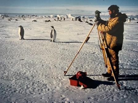
New Zealand first sent surveying personnel to Antarctica in 1956, and this work continues to support scientific projects today.
In 1959, the Department published the first Descriptive Atlas of New Zealand, and in 1968 the first New Zealand Gazetteer of Place Names.
The Department of Lands and Survey split into the Department of Conservation (DOC), Landcorp, the Department of Lands and the Department of Survey and Land Information (DoSLI) in 1987 following the Survey Act 1986.
Land and deeds remained part of the Justice Department (and later became part of DOSLI in 1995), and DOC inherited conservation matters. The Department of Lands looked after residual land matters and Crown land rights, while Landcorp became a state-owned enterprise with responsibility for property used for commercial farming and associated activities.
On 1 July 1996, DoSLI was split into Land Information New Zealand and a state-owned enterprise (now a private company) called Terralink. LINZ was placed in charge of core government land related regulatory and purchase functions, with Terralink in charge of commercial activities.
At the same time, the responsibility for hydrographic services came into LINZ from the Royal New Zealand Navy.
Today, LINZ is the government’s lead agency for property and location information, Crown property and regulating overseas investment, working across land, sea, data and regulatory areas.
Sam Anderson is Business Partner – Strategic Communications, with Toitū Te Whenua Land Information New Zealand.