

The combination of satellite imagery and AI has been shown able to detect, with high accuracy, two types of invasive weeds in Australia.
The technique has the potential to provide a new opportunity for defence against and defeating these pervasive plants.
The research, conducted by academics at Charles Darwin University (CDU) and Charles Sturt University (CSU), explored the potential for SkySat satellite imagery and AI algorithms to detect and map African lovegrass (Eragrostis curvula) and bitou bush (Chrysanthemoides monilifera ssp. rotundata).
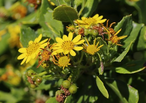
African lovegrass is a highly invasive perennial grass, while bitou bush, classified by the federal government as a Weed of National Significance, is an aggressive shrub that invades coastal dune vegetation, smothers native plants and significantly reduces coastal biodiversity.
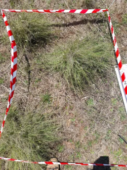
Detection of these species, particularly African lovegrass, is costly and complicated due to infestations occurring at large scales and in mixed landscapes.
Cost-effective
The academics fed SkySat satellite imagery of locations across New South Wales into two machine learning algorithms. One model could detect African lovegrass with 89.9% accuracy and bitou bush with 86.1% accuracy.
Co-author and CDU Spatial Analyst Glen Shennan, who has expertise in African lovegrass, said this method could become a critical component in the cost-efficient, rapid detection and monitoring of invasive weeds and plants in Australia.
“Ground sampling is very labour-intensive. If we can make drones and satellites work, it can cut down the cost enormously and you can do this repeatedly to see where the species are spreading,” he said.
Mr Shennan said there is a desperate need for rapid, cost-effective methods to detect these species, in particular African lovegrass.
“African lovegrass is very opportunistic in the way it grows and can out compete native grasses,” Mr Shennan said. “It’s not palatable or nutritious. Sheep and cattle avoid as far as possible.
Satellites to the rescue
Mr Shennan said the accuracy of the results was significant for invasive weeds such as African lovegrass because it can be difficult to identify.
“It looks a lot like poa tussock when it’s young. Even experienced botanists have trouble differentiating the two, which is where satellites and some types of drones come in,” he said.
“They can identify different colours we can’t see, and with this we hope we can identify its growth patterns.”
In their paper, the researchers write that “SkySat satellites produce high-resolution imagery (0.50 m/pixel), increasing the potential for detecting species in mixed landscapes at scale, compared to moderate-resolution sensors such as those on Sentinel-2 and the Landsat systems”.
“Although the challenges associated with mixed species were evident in this study, the emergence of ultra-high [-resolution] Earth observation satellites, such as SkySat, can be a significant enabler in the cost-efficient, rapid detection and monitoring of invasive plants in Australia.”
The study, Investigating the Potential for the Detection of African Lovegrass and Bitou Bush Using SkySat Earth Observation Satellites, was published in the journal Weed Research.
The research was supported by the Australian Government’s Department of Agriculture, Water and the Environment. The study was also authored by CDU Lecturer in Remote Sensing Dr Richard Crabbe, and CSU Senior Lecturer in Livestock Production Management Dr Jane Kelly.


