

South Australia’s Country Fire Service is boosting its geospatial and mapping capabilities to help plan for and manage bushfires across the state.
One of the most important changes to bushfire mitigation planning is the adoption of BMAP 2.0, the latest iteration of Bushfire Management Area Plans (BMAPs).
BMAPs are used to guide how bushfire risk reduction activities are planned and prioritised, assist agencies to collaborate on activities that reduce the risk to communities before fires start.
The BMAP 2.0 system will be based on a bushfire planning system currently in use with the New South Wales Rural Fire Service.
The project, which is being delivered by the Country Fire Service (CFS) on behalf of the State Bushfire Coordination Committee, will replace the current system with a more modern, evidence-based approach.
That new approach will help Bushfire Management Committees plan for, assess and track bushfire mitigation activities over time.
Initial roll-out of BMAP 2.0 capabilities is expected to take place within six months.
The project is being funded through $1.8 million from the National Emergency Management Agency Disaster Ready Fund plus $2.7 million over four years from the South Australian government.
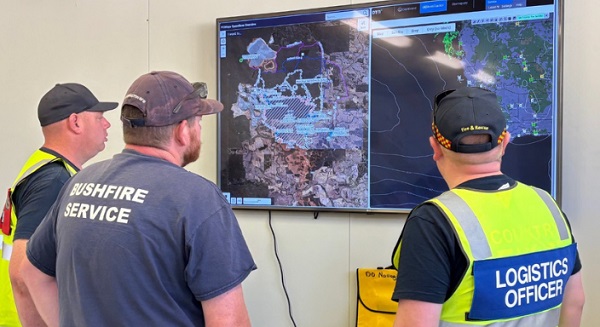
The CFS has also announced the deployment of the Firemapper system as its long-term tactical mapping platform.
Firemapper provides near-real-time mapping and is already used by numerous Australian state authorities as well as international agencies.
Although CFS Aviation has used the system for the past seven years, Firemapper was first trialled across the broader CFS during the 2024/25 fire season.
Considered a success, the trial was extended to the current 2025/26 season while procurement processes were begun.
Firemapper enables firefighters to add and subtract data as conditions change, to ensure information stays up to date.
It was recently used by CFS crews who deployed to Western Australia to help tackle the Newmont Goldmine bushfire, where the system’s ability to produce a single tactical picture was of great benefit for co-ordination and the mopping up of hotspots.


