

In our regular Spatial Snippets feature, we bring you a round-up of all the bits and pieces of geospatial news that didn’t make it into our normal daily coverage.
Do you have a Spatial Snippet to share with our 8,000-strong newsletter list? Please send us an email.
A few weeks ago, we brought you news that James Cook University will be working with colleagues and partners in the Solomon Islands to develop a short course in spatial science at Solomon Islands National University (SINU), with a view to helping SINU establish the country’s first spatial science degree program. The team has reached out to us to advise that the position of Assistant Professor in Geospatial Science has now been advertised. It’s a full-time position for five years, based in Honiara. Get in quick; the application deadline is 19 December.
Still in the South Pacific, and the Kāpiti Coast District Council in New Zealand has an opening for a Senior Geospatial Analyst. The role involves working on GIS projects, assisting Council staff and the public with the Council’s GIS web applications, and providing expert advice.
Toitū Te Whenua Land Information New Zealand has released some interesting statistics regarding the use of its Landonline platform. In the 2024-25 fiscal year, 3 million searches were conducted, 11,400 cadastral survey datasets (CSD) were completed and uploaded, and 257,000 dealings were lodged. There are now 13,000 customers actively using the platform, with the record for the most dealings lodged by a single customer being 4,800!
Still in New Zealand, and the Surveyor-General has published a prescription to be used by surveyors who are preparing a survey plan to support a recognition order for customary marine title under section 109(4) Marine and Coastal Area (Takutai Moana) Act 2011. Surveyors are advised to consult with the Office of the Surveyor-General before preparing a CSD so that any issues can be pre-emptively and collaboratively resolved.
The Australian Institute of Navigation (AIN) has announced a formal MOU with the Royal Institute of Navigation (RIN) in the UK. The MOU covers: the sharing of updates on international PNT developments, Australian priorities, and research opportunities; coordination through the AIN of PNT and broader navigation-related issues relevant to Australia; and collaboration on promoting Australian expertise and leadership in PNT to international audiences.
Earlier this year, the AIN and the Australia-based International Global Navigation Satellite Systems (IGNSS) merged to become a single body. The first of its new series of biennial PNT conferences will be held in Sydney in February.
There’s been an update for Queensland’s Cadastre and Address Modernisation (CAM), with the announcement of the availability of the Beta 2.0 dataset from the Queensland Spatial Cadastral Fabric (QSCF). The QSpatial download of ‘Queensland Spatial Cadastral Fabric (QSCF) – whole of State Queensland’ can be found on QSpatial. The 4GB beta dataset is for testing purposes only, with its metadata not yet finalised. Users should continue using the existing DCDB cadastral data datasets for official purposes.
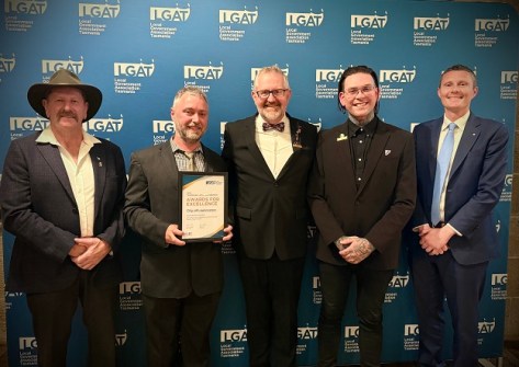
The City of Launceston was recognised at last month’s Local Government Association of Tasmania 2025 Awards for Excellence, taking out an award in the Showcasing Innovation category. Since 2021, the Council has imported its LiDAR scans of the city into the game Minecraft, to enable gamers to play within maps based on Launceston’s topography. The project also took out a Social Innovation award at the 2025 TasICT Awards earlier this year.
“It’s given Northern Tasmanian students the chance to look at things like open spaces, transport, flood protection and planning through fresh eyes and they’ve come up with some genuinely exciting ideas,” said the mayor, Matthew Garwood.
Make sure you don’t miss out any geospatial news from across Australia and around the world — subscribe to our free Spatial Source newsletter, sent out every Wednesday and Friday morning.


