

In our regular Spatial Snippets feature, we bring you a round-up of all the bits and pieces of geospatial news that didn’t make it into our normal daily coverage.
Do you have a Spatial Snippet to share with our 8,000-strong mailing list? Please send us an email.
Hot on the heels of the announcement that Jacobs (along with Terria and Amristar) had been awarded the contract to develop the spatial digital twin for Spatial WA, comes news that Accenture has been awarded the contract to develop the project’s Next Generation Spatial Cadastre. As explained in our earlier article, the two elements are to be the backbone of Spatial WA, with the Next Generation Spatial Cadastre to set “provide the technology to uplift the state’s current 2D spatial cadastre to maintain property rights, restrictions and responsibilities in 3D/4D across government”.
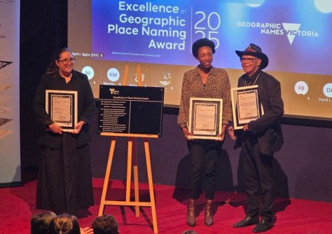
Two councils in Victoria have received Excellence in Geographic Place Naming awards. Baw Baw Shire Council was awarded for naming Angela Malacarne Park, which recognises Angela Malacarne’s contributions to and connection with the area, where she was a student and later a teacher for almost 40 years.
Brimbank City Council and Wurundjeri Woi-wurrung Cultural Heritage Aboriginal Corporation were awarded for the naming of yaluk barring park, with the name meaning ‘river trail’ in Wurundjeri Woi-wurrung language. The park is situated where three rivers meet.
“It is fantastic to see Victoria’s naming authorities taking these steps to increase diversity and equality in geographic place naming, through the use of First Nations languages and female commemorative names,” said Craig Sandy, Victoria’s Registrar of Geographic Names.
Registrations are still open for the Australian Institute of Mine Surveyors’ (AIMS) Hunter Valley Regional Seminar to be held on 21 November at the Mercure Hotel at Pokolbin, in the picturesque NSW Hunter Valley. The organisers are expecting that around 4.5 CPD points will be available to those who attend.

A UNSW team led by Professor Andrew Dempster, Dr Yang Yang and Professor Junichiro Kawaguchi, has been awarded $685,000 under the ARC Discovery Project 2026 round, to advance positioning, navigation and timing (PNT) techniques for use in cislunar (i.e. between and around the Earth and the Moon) space.
According to the award citation, the project expects to “i) develop a framework for single-satellite Doppler positioning to be deployed in advance of PNT systems, ii) generate advances in autonomous on-board accurate positioning of lunar navigation satellites, and iii) develop a technique for time synchronisation of lunar PNT satellites. Expected outcomes include significantly improved lunar PNT accuracy, and algorithms that can be used by the Australian ‘Roo-ver’ robotic lunar mission. Significant benefits include advancing knowledge and the development of novel methods to expand Australia’s capability in lunar PNT.”
Hexagon has announced it has struck an agreement to acquire Inertial Sense, a supplier of tactical-grade global navigation solutions and inertial navigation systems. Utah-based Inertial Sense claims to have more than 30,000 inertial systems deployed worldwide, able to deliver centimetre accuracy.
It has been a big month so far for launches of synthetic aperture radar (SAR) satellites. Here’s a video of last week’s launch of Sentinel-1D. Once fully commissioned, the satellite will join with its sibling, Sentinel-1C, in studying the Earth at C-band wavelengths. The two craft will be in the same orbit, but 180 degrees apart.
The Sentinel-1 spacecraft orbital characteristics are:
- Type: Sun-synchronous
- Period: 98.74 minutes
- Sense: Ascending
- Inclination: 98.19 deg
- Altitude: 693 km
- Local solar time: 18:00
- Repeat cycle: 12 days
And here’s another launch, this time from Rocket Lab in picturesque New Zealand. The launch vehicle was carrying the QPS-SAR-14 SAR satellite for the Institute for Q-shu Pioneers of Space (iQPS) in Japan. This was the sixth iQPS deployment for Rocket Lab, with another six remaining on the manifest.
In other SAR news, Rheinmetall and ICEYE have completed setting up their joint venture, Rheinmetall ICEYE Space Solutions, in Neuss, Germany. The first satellite will be manufactured in 2026. In September, ICEYE announced that its new satellite design, Gen4, is now available. ICEYE claims that Gen4 will deliver “the world’s highest-fidelity commercial SAR imagery of up to 16 cm resolution” that “extends the high-resolution field of regard to 400 km”.
Finally, if you’re into the history of mapping and cartography, you might like to take a look at the following video, in which cartographic historian Chet Van Duzer (University of Rochester) gives a lecture on early modern maps and the techniques used by mapmakers to indicate certainty and uncertainty about accuracy.
Make sure you don’t miss out any geospatial news from across Australia and around the world — subscribe to our free Spatial Source newsletter, sent out every Wednesday and Friday morning.


