

Credit: Floodmapp
Australian company FloodMapp has been awarded a contract to provide the US Department of Homeland Security’s (DHS) Federal Emergency Management Agency (FEMA) with operational flood inundation and analytics data feeds, including assessment of potential damage to properties.
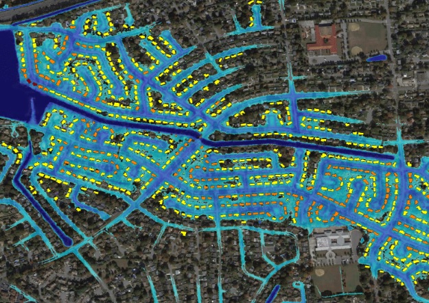
FEMA will use FloodMapp’s analytics to understand flood affects on people, property and critical infrastructure before, during and after flooding events, and support a common operational picture for its National Flood Insurance Program.
FloodMapp’s Dynamic Automated Scalable Hydroinformatics model, DASH, simulates coastal, riverine and pluvial flooding with an ability to scale across large areas and provide emergency managers with real-time situational intelligence.
“These products are already being used operationally today in Australia and the United States to help government agencies coordinate targeted evacuations, inform road closures and operational traffic routing, and fast track community recovery with targeted distribution of funding and resources,” said FloodMapp CTO and Co-Founder Ryan Prosser.
“We have successfully supported emergency managers within local, state, and federal government in Australia through some of the worst flooding the country has ever seen.”


