

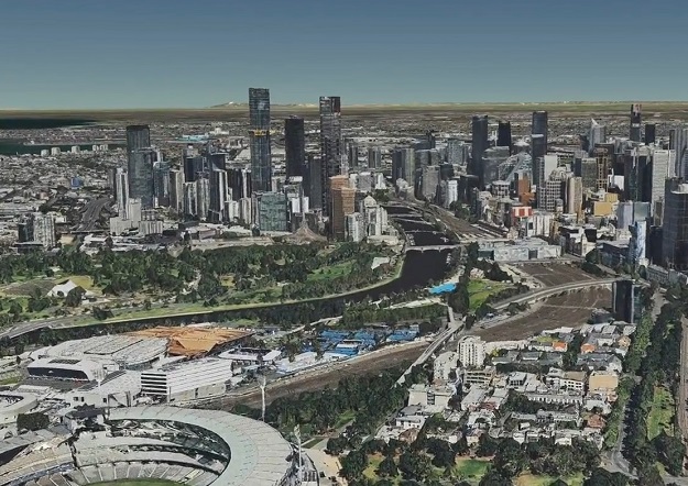
The eagerly anticipated Digital Twin Victoria (DTV) platform is now live, following completion of its first development phase.
The digital replica of the state is being built in partnership with Australia’s National Science Agency CSIRO.
The platform is just one piece of the DTV program, a $37.4 million investment by the Victorian Government in digital twin technology and spatial innovation.
The project aims to revolutionise the planning and management of the built and natural environments.
The DTV platform brings together a huge volume of 2D, 3D and live data in a single online portal. It will “help leave behind manual, labour-intensive and paper-based ways of doing things, building the digital foundations and skills needed to support a liveable and sustainable Victoria”.
The launch of the DTV platform is the first step in what will be a long evolution, with more data and functionality to be added as time goes on.
Planners, engineers, developers and builders can now use the platform to “visualise data, investigate the feasibility of proposals, troubleshoot issues and share complex information across workplaces and with decision-makers”.
The DTV platform will also enable the planning and building industries to virtually manage a development precinct or project area. Using the platform tools, they can virtually model overshadowing and underground utilities, for instance.
Councils will be able to bring together data visualisations with 3D building models, vegetation records, population statistics and local sensor data, making it easier to plan and manage towns and cities.
The DTV platform will also connect a new generation of tools such as eComply, being developed as part of the Digital Twin Victoria program.
The DTV platform is built using CSIRO Data61 TerriaJS open-source technology. It already contains more than 4,000 datasets.
Stay up to date by getting stories like this delivered to your inbox.
Sign up to receive our free weekly Spatial Source newsletter.


