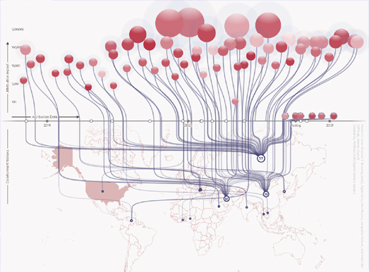
Foreign Interference in the 2020 Election
 Maps Mania
Interference 2020 – Foreign Interference Attribution Tracker is a visualisation of foreign interference in this year’s U.S. Presidential Election. The map was created by the Digital Forensic Research Lab of the Atlantic Council to explore and examine allegations of foreign interference in the U.S. election.
 The Map Room
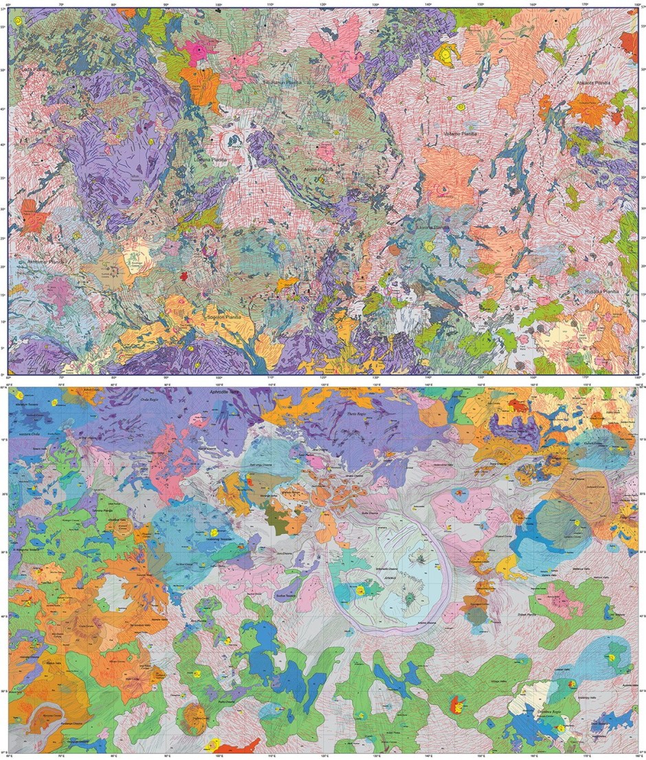
Two geological maps of Venus have been published in Earth and Space Science. Produced by Vicki L. Hansen and Iván López, they each cover a 60-million-square-kilometre section of Earth’s twin.

Map of the week
The Australian Strategic Policy Institute (ASPI) is documenting the Chinese government’s treatment of Uyghurs and other minorities in the remote northwestern province of Xinjiang. Using open data, satellite images and Chinese government documents they have created an interactive map.
Call for Maps: 2021 GeoHipster Calendar
 GeoHipster
Could your map be the cover of the 2021 GeoHipster Calendar? All the details are available on the 2021 calendar page. Happy Mapping!
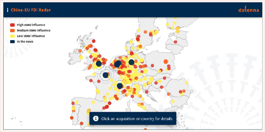
Chinese Acquisitions in Europe
 Maps Mania
Over the last year there has been a lot of speculation about the security threat posed by Chinese technology companies such as Huwei and Tik-Tok. Datenna has identified over 650 acquisitions by Chinese investors in Europe.You can view all these acquisitions on the China-EU FDI Radar interactive map.
Stay up to date by getting stories like this delivered to your mailbox.
Sign up to receive our free weekly Spatial Source newsletter.