A comprehensive geospatial mapping project has commenced at the Australian Wildlife Conservancy’s (AWC) Mornington Wildlife Sanctuary (Bunuba and Kija country) in the central Kimberley, to assist in the site’s post-flooding restoration.
The newly launched J2 Geospatial Intelligence Service (J2 GIS), a social enterprise of the veteran-led non-for-profit Disaster Relief Australia (DRA), has signed on to conduct the topographical analysis of last year’s unexpected weather event.
Having launched in late 2023, J2 GIS builds on the strength and experience of Disaster Relief Australia’s Aerial Damage and Assessment Team and leverages the skills and expertise developed through years of providing disaster intelligence, adapting these for commercial applications across a broad range of industries.
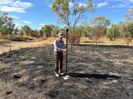
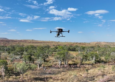
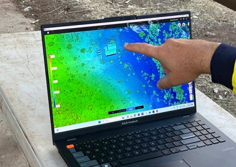
The mapping project at Mornington — the enterprise’s first official field project — saw a team of J2 GIS geospatial technicians make its first visit to Mornington last month, equipped with a fleet of aerial drones and ground-based sensors.
Markus Bucy, Executive General Manager of J2 GIS and Co-founder of DRA, said the effort will deliver highly accurate maps, data and 3D models that will help inform AWC’s reconstruction plans.
The information gained through the surveys will not only build a picture of how the past flooding events occurred, but will enable informed decisions to be made about restoring activities and infrastructure at the site.
“We are proud to partner with AWC on this project, and the completed modelling generated by the photogrammetry and LiDAR surveys of the flood impact area will help the rebuild process ensure more resilient facilities,” said Bucy.
“The partnership demonstrates the value and benefit of engaging with social enterprises like ours – every dollar earned from this project helps put DRA volunteers on the ground when they are needed in the future.”
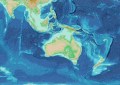
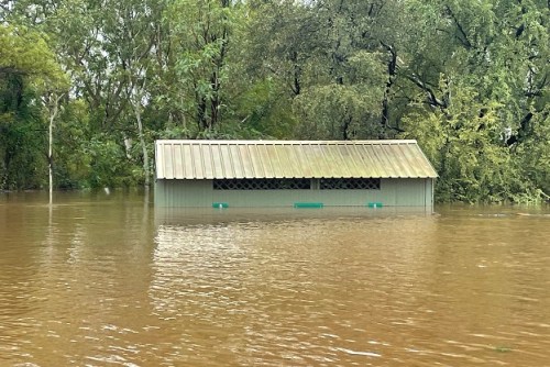
Mornington’s operation base was among the many sites across central Kimberley to be affected by flooding in January 2023, caused by heavy rainfall from ex-Tropical Cyclone Ellie. The largest recorded flood event forced staff and visiting researchers to evacuate by helicopter, as personal belongings, work equipment and infrastructure, and years of herbarium specimens were severely damaged or washed away.
Late last year, significant headway was made in Mornington’s recovery thanks to volunteers from Disaster Relief Australia who helped clear 18 tonnes of debris during a week-long clean-up.
“We’re thrilled to extend our relationship with Disaster Relief Australia by leveraging on the skills and expertise of the team at J2 Geospatial Intelligence Service,” said Chloe Kobel, AWC Assistant Operations Manager in the Kimberley. “J2 GIS’ geospatial mapping and modelling will inform our recovery efforts and strengthen Mornington’s.”
Over the next few weeks, J2 GIS will process the data collected at Mornington off-site to produce mapping, digital elevation and 3D models.