The Intergovernmental Committee on Surveying and Mapping’s (ICSM) 3D Cadastral Survey Data Model project is on track to deliver a standard specification for exchanging Australian and New Zealand cadastral survey data.
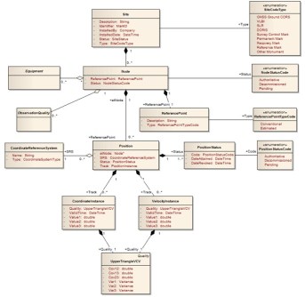
To date, schema encoding of the 3D conceptual model (developed during the last phase) in JSON-LD is almost complete and is presently being tested with 2D data. Capability for handling jurisdictional differences via profiling is also taking shape. Work is progressing well on the development of extensions for managing 3D cadastral survey data, and (open source) code for parsing cadastral data according to the schema and jurisdictional profiles.

The project is scheduled to complete in early 2024 and will deliver a harmonised approach based on modern international standards (from OGC, W3C etc) for exchanging 2D cadastral data according to Australian and New Zealand Surveying regulations and Registrar’s requirements.
In coming months, open-source resources will be made publicly available to assist survey software providers with implementation and to expedite the production of 2D cadastral survey datasets according to the new specification. Extensions for exchanging 3D cadastral data will be the focus of the next phase.


