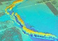
Output of a Freestyle 2 scan of a Corvette’s interior. Image provided.
Faro has announced the release of its next-generation handheld reality capture device.
Aimed at forensics teams and investigators, the Freestyle 2 offers single-handed operation and real time visualisation from its two cameras and laser scanner.
The device is aimed for speed and ease of use to quickly capture scenes at ranges of 0.4 to 10 metres, according to David Dustin, FARO’s director of industry solutions, public safety.
“We believe Freestyle 2 is the most intuitive, portable and easy-to-use handheld scanner on the market today. This compact device is a game changer for the public safety arena given its remarkable degree of photorealism and data capture,” he said.
The lightweight unit is designed for typical interior and outdoor light levels of 10,000-45,000 lux and has an integrated display, so no tablets or monitors are necessary. Faro says that the integration of all components into a single device allows easier white balance calculations and on-site compensation.
Its operating system features Faro’s tracking engine designed for capture during natural movements, and contains an alert system to advise the user when changes to scanning motion may yield better results.
“At a time when law enforcement and other agencies are understaffed and under significant time pressure, investigators and reconstructionists around the world stand to gain significant benefit from our innovative and intuitive Freestyle 2,” added Dr. Michael Carris, FARO’s VP of product marketing.
Stay up to date by getting stories like this delivered to your mailbox.
Sign up to receive our free weekly Spatial Source newsletter.