The Velos UAV helicopter has passed field tests to become the first single-rotor helicopter supported by UgCS software. UgCS now enables UAV helicopter professionals to use Velos for photogrammetry and LiDAR surveying missions.
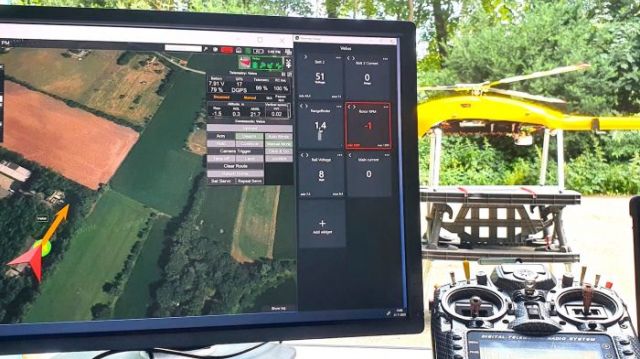
UgCS is now able to support the twin engine telemetry providing input for a UAV. The newly created Telemetry Viewer can handle extensive telemetry from such complex drones. This allows for optimal flying of the Velos helicopter, with a fully redundant twin-motor design and double key components. UgCS makes piloting easier and safer, allowing for the control and monitoring of one or multiple Velos helicopters on a single mission in both single and multi-operator modes.
The field tests were initiated and conducted by Irish GeoInspect, the first company to use UgCS with its Velos helicopter. The new solution allows professionals to fine-tune projects, resulting in maximum performance and very high usability. One of the projects was a fully autonomous test flight with UgCS.
GeoInspect founder Bart Zondag explains: “GeoInspect has been performing LiDAR surveys successfully with UgCS for many years. Having started with the M600 model, UgCS is now used to support single rotor UAV. We have already delivered a Velos V2 with UgCS to one of our customers to the EU Nordics to perform LiDAR forestry surveys”.
Stay up to date by getting stories like this delivered to your mailbox.
Sign up to receive our free weekly Spatial Source newsletter.