Western Australia hit by powerful earthquake

By on 18 December, 2018

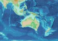
Australia’s second-largest earthquake in two decades struck north-western WA on Sunday night.

The 5.9 magnitude earthquake struck offshore, around 100 kilometres from Coral Bay, at a depth of 10 kilometres at around 10:26 pm local time.

The Joint Tsunami Warning Centre advised that there was no tsunami threat from the submarine ‘quake, which was felt as far south as Perth — around 1,000 kilometres from the epicentre.

Coral Bay residents reported experiencing violent tremors, but no significant damage has yet been reported.

The main event was soon followed by a 3.7-magnitude aftershock off the coast of Carnarvon, with Geoscience Australia warning that tremors with a magnitude of around 3 would be plausible following an event of this scale.

Stay up to date by getting stories like this delivered to your mailbox.
Sign up to receive our free weekly Spatial Source newsletter.

You may also like to read:


, , , , , ,


Newsletter

Sign up now to stay up to date about all the news from Spatial Source. You will get a newsletter every week with the latest news.

Q&A with Zaffar Sadiq Mohamed-Ghouse
Combatting climate change, saving lives and building better ...
Satellite imagery helps coastal data collection
A new study highlights the accuracy of satellite-derived bat...
Geospatial in School Awards recipients announced
Two outstanding teachers and a high school student have been...
The geospatial reality capture revolution
Aptella’s solutions are transforming spatial data and revo...
Evolution in survey: XGRIDS and Gaussian splats
Using 3DGS and SLAM technology, XGRIDS bridges the gap betwe...
Emlid joins Esri’s global Partner Network
The move will enable Esri ArcGIS users to take advantage of ...