


Handling large mapping projects, meeting deadlines and delivering high-quality results are typical challenges in photogrammetry. This is particularly true during peak where multiple projects, often comprising tens of thousands of images, need to be processed in a timely manner. Mapping firms can greatly benefit from better control of project schedules, a reduction in processing times […]
Search results for "UAV"
ScanX automates surveyors’ 3D point cloud data
Software start-up ScanX offers a new cloud-based platform to upload and automate surveyors’ 3D point cloud data using artificial intelligenc
ScanX automates surveyors’ 3D point cloud data
ScanX Cloud eliminates the time consuming task of manual processing and offers unrivalled accuracy and flexibility of the cloud.
Read full story • Comments are closed

Registration for Geo Connect Asia now open
Geo Connect Asia 2021 will combine plenary sessions and conferences in a hybrid format.
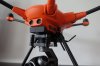
Single-rotor helicopter for surveying
The Velos UAV helicopter has passed field tests to become the first single-rotor helicopter supported by UgCS software.
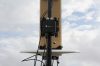
DroneShield rolls out new AI classification system
DroneShield claims a dramatic increase in detection responsiveness from its first fully AI-driven system.
Geo Connect Asia
When:
24 March, 2021 @ 9:00 am – 25 March, 2021 @ 11:45 pm
Where:
Marina Bay Sands hotel, online
Geo Connect Asia looks to host their ASEAN neighbours and build on a vibrant community as new technologies add new application tools to enable the Industry 4.0 Revolution. The emergence of AI, blockchain, IoT, robotics[…]

Time is honey
Predicting future honey harvests with 90% accuracy using remote sensing and weather data.
Sky Drone joins Nvidia incubator program
Hong Kong’s Sky Drone has joined Nvidia’s Inception AI processing incubator program.

ParaZero, Delta Drone merge to form Delta Drone International
The new ‘drones as a service’ company will be headquartered in Adelaide.