Specialist Australian hydrographic and geophysical surveying Revelare Hydrospatial, and international geospatial firm Hexagon, have signed new partnership agreements with the Seabed 2030 project.
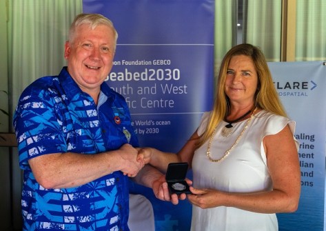
The memorandum of understanding between Revelare Hydrospatial (formerly Precision Hydrographic Services) and Seabed 2030 was signed by Seabed 2030 Director, Jamie McMichael-Phillips, and Revelare Hydrospatial’s Principal Geophysicist, Elizabeth Johnstone.
“Partnering with Revelare Hydrospatial marks a significant step in our work to achieve a complete map of the world’s ocean,” said McMichael-Phillips.
“Revelare’s expertise in both hydrography and geophysics will enhance our efforts — especially in the South Pacific, where accurate ocean mapping and geohazard data can support regional safety and sustainable development.”
“We are excited to participate in this initiative, especially with so much left to be discovered and surveyed in the South Pacific region,” said Johnstone.
“Our team is ready to bring our talent and technology to support Seabed 2030’s global vision.”
The agreement with Hexagon also was signed by McMichael-Phillips, along with the Vice President of Bathymetric Services at Hexagon’s Geosystems division, Andrew Waddington.
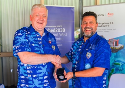
“We are delighted to welcome Hexagon as a valued partner in our mission to achieve a fully mapped ocean floor,” said McMichael-Phillips.
“Hexagon’s advanced digital capabilities and commitment to innovation are invaluable as we work to create a definitive map that will benefit science, industry, and conservation efforts across the globe.”
“Hexagon is proud to support Seabed 2030’s ambitious goal of compiling a map of the global seafloor by the end of the decade,” said Waddington.
“This collaboration aligns with Hexagon’s vision of using cutting-edge technology to improve our understanding of our world and work towards a more sustainable future.
The agreements were formalised at the recent Pacific Ocean Mapping Meeting in Nadi, Fiji, which brought together a range of participants to address ocean mapping imperatives across the Pacific region.
They come shortly after Geoscience Australia signed a new partnership agreement with Seabed 2030, and reflect a growing interest in ocean floor hydrography in the region.