Major General Dick Wilson, the newly appointed chair of the Queensland Reconstruction Authority (QRA) and the Director of the Defence Intelligence Organisation, will provide his perspective of the devastating 2011 natural disasters that brought an entire state to breaking-point, at Ozri 2011.
As the head of the agency tasked with rebuilding Queensland, Major General Wilson will provide a unique perspective into the ongoing role of geospatial technology in large scale emergency response and recovery efforts.
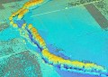
The QRA’s interactive online GIS, which features crowd-sourced reconstruction imagery and up-to-date information from areas affected by the natural disasters, continues to put spatial technology in the national spotlight by providing Australians with an insight into how the nation’s biggest reconstruction effort is unfolding.
Hosted by Esri Australia, Ozri 2011, which runs from the 12–14 October in Melbourne, will showcase the latest developments in the spatial industry and highlight creative applications of the technology.
Major General Wilson will be joined at the event by a host of special guests and many of Australia’s leading geo-enabled businesses, councils and government agencies. Together they will explore some of the most compelling spatial projects undertaken in recent times.
To view Ozri 2011’s full program of speakers or to register visit: www.esriaustralia.com.au/ozri