Pix4D has announced a partnership with SAP on a joint innovation project to automate modelling of transmission masts for telco companies.
Under the new partnership, Pix4D technology for inspecting transmission masts with drones, cloud computing and artificial intelligence (AI) will be implemented in SAP’s S/4HANA platform and integrated into SAP Asset Management.
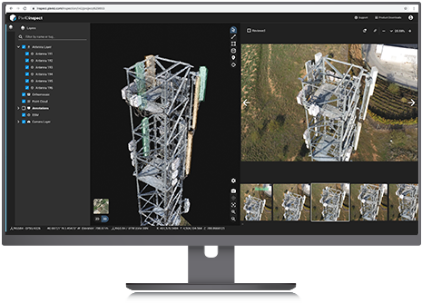
Pix4D says that companies using this integrated product can collect data from drones from the ground to automatically create accurate 3D models of transmission masts and telecommunications systems with its mobile apps.
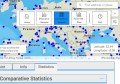
The company says these digital copies can then be examined in a virtual environment, with machine learning algorithms helping to automatically measure the sizes and orientations of the antennas — the data then synchronising with SAP S / 4HANA and existing company data.
“There is a paradigm shift in the inspection industry,” said Pablo Santos, Business Strategy Manager for the inspection industry at Pix4D.
“3D representations of reality are becoming information platforms. In cooperation with SAP, we are developing automated and agile processes into a new standard for operational and financial decisions in asset management.”
Stay up to date by getting stories like this delivered to your mailbox.
Sign up to receive our free weekly Spatial Source newsletter.