

A hydrographic survey of the seafloor along the coast of Otago in New Zealand will give authorities their best look at the region since the last surveys were made in the 1950s and 1980s.
Being conducted by Ocean Infinity on behalf of Toitū Te Whenua Land Information New Zealand (LINZ), the survey will result in the production of updated nautical charts to ensure safe navigation.
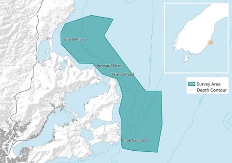
The areas to be covered includes Blueskin Bay, Heyward Point, Taiaroa Head and Cape Saunders. This will be the first time these areas will have been surveyed using modern equipment capable of collecting high-resolution data.
It is expected that the survey might identify previously unknown features such as reefs, shoals and wrecks. It will also re-check the depths of known objects.
“Every area of New Zealand waters we survey helps ensure Kiwis and shipping companies have the latest information to safely navigate our waters,” said LINZ Senior Hydrographic Surveyor, Bradley Cooper.
“Locals will be able to see the vessel charting back and forth off the coast and we are also giving the public the opportunity to virtually step aboard the boat and learn more about the survey during a free seminar on 18 July.”
The data collected during the survey will be of assistance in planning for events such as tsunamis, as well as for marine resource management and for research.
It is expected that the survey will be completed by the end of July.


