A new guide to the uses of geoinformation technologies for reducing risks and loses from disasters is now available.
“Geoinformation for Disaster and Risk Management” has been designed to help explain the potential uses of geoinformation to governments, decision makers and disaster professionals. The 142-page guide covers an array of global disaster-related issues.
The information is a response to the numerous disasters, including storms, volcanoes and earthquakes, that cause damage and death to property and people around the world. According to the authors, many of the losses could be prevented if better information, such as environmental factors and patterns and behaviours of hazards, was readily available.
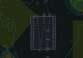
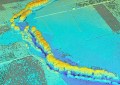
The booklet covers a range of technologies and applications of geospatial data, such as using high resolution satellite data to monitor the size and growth of refugee camps, using GIS for global disaster alerts and coordination and rapid mapping of flooding.
The booklet was produced by the Joint Board of Geospatial Information Societies (JBGIS) and the United Nations Office for Out Space Affairs (UNOOSA). The authors aim to demonstrate how geoinformation technology can be efficiently integrated into disaster management.
The booklet can be downloaded from the JBGIS website.