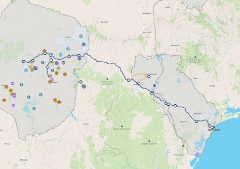
Detailed maps have been released showing where highway upgrades will be needed to ensure wind turbines and other large pieces of equipment can be trucked to one of NSW’s new renewable energy zones.
The maps show the route to be taken from the Port of Newcastle to the Central-West Orana Renewable Energy Zone (REZ) on the western side of the Great Dividing Range.
The 19 specific locations identified as ‘pinch points’ are on the Golden Highway between the Port of Newcastle and Elong Elong, as well as a section of the Castlereagh Highway.
Interested parties can explore the maps online. They show:
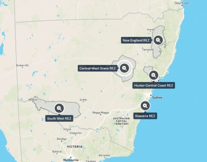
- All of NSW’s Renewable Energy Zones
- Land boundaries — federal and state electorates, local government areas, Aboriginal Land Councils and lot boundaries
- The existing electricity distribution network
- Transmission and battery projects
The ‘Port to REZ’ highway upgrades will be funded by the Australian and NSW governments, with $128.5 million announced towards 320 kilometres of road upgrades and ancillary works.
The upgrades will enable the transportation of wind turbines and other crucial components needed for wind and solar farms and the transmission network that connects them.