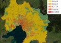
Asset management and defect remediation is estimated to cause over $3 billion in damages per year to Australia Government-owned assets alone. Graffiti, litter, damaged street furniture – just to name a few – are problems that most asset owners struggle to deal with effectively.
GIS People, in collaboration with Pricewaterhouse Coopers and an unnamed client have created a mobile solution, Gruntify, which is suitable for crowd-sourced asset management as well as other tasks such as disaster response.
Gruntify provides an end-to-end technical solution that makes it easy to:
- Collect data with location information,
- Ensure quality control of inputs/outputs,
- Schedule jobs for remediation,
- Employ geospatial analysis for hotspot identification, and
- Implement financial reporting.
It’s a cloud-based solution, and does not require any additional software. The system comprises two major components:
- A field capture app – for crowdsourcing data from the public and/or staff. The app captures item location, type, photo, additional notes and user details in seconds; both iOS and Android versions for phones and tablets are available now.
- An admin panel – a real-time central database of each submitted item. Admin users can accept, reject, and organise data submissions, view real-time maps, schedule jobs, track trends and hotspots, export analysis data for reporting, and much more.
The app and admin panel are flexible and can be branded with the logos and colour schemes that suit individual clients with 1 to 1,000,000 users.