

In a wide-ranging interview, Matt Higgins distils the 50-year history of GPS and expounds on what the future may bring for PNT.
Matt Higgins has been intimately involved with the surveying and positioning sector in Australia for more than four decades, and in that time has served with many domestic and international boards, panels and organisations. He is currently the president of the International Global Navigation Satellite Systems (GNSS) Association and a member of the US Government’s National Space-Based PNT Advisory Board. Last year he was awarded the Public Service Medal in the King’s Birthday 2023 Honours List, for outstanding public service to Queensland and for achievements internationally in the fields of surveying, geodesy and spatial sciences.
We spoke with Matt to learn more about his career and to get his thoughts on the past, present and future of positioning, navigation and timing (PNT).
Spatial Source: Please tell us about your career and your involvement in PNT.
Matt Higgins: While studying for my bachelor’s degree in surveying, I had a cadetship with the Queensland Department of Mapping and Surveying and did geodetic survey work all over the state; primarily using laser geodimeters but also satellite positioning based on the Transit System. For my final year undergraduate project in 1982, I thought I would focus on the Transit system but my supervising surveyor, Graeme Rush, suggested that I should focus on the emerging Global Positioning System (GPS). So, ironically, my start in PNT was very much a matter of being in the right place at the right time.
A few years later, while doing my master’s degree, I was involved in the Department’s first GPS survey in Queensland and I also published the first widely used parameters for transforming between WGS84 and our local datum, AGD84. On completing my Masters, I did a six-month study tour of the US in 1989 and eventually became the Department’s lead person in GPS. Another key achievement was leading the development of SunPOZ, one of the first RTK networks in the Southern Hemisphere.
My roles as a Commission Chair and then as a Vice President of the International Federation of Surveyors (FIG) were also pivotal in my PNT development. I represented FIG as a founding Associate Member of the UN International Committee on GNSS and Co-Chaired one of its Working Groups. After I finished in FIG, in 2010, I was appointed by the NASA Administrator to the US Government’s Advisory Board for Space-Based Positioning, Navigation and Timing (PNT). In recent years I have also been President of the IGNSS Association in Australia.
SS: What was the genesis of GPS?
MH: The concept of satellite positioning was famously developed when scientists realised that they could measure the distance to the Sputnik satellite (launched by the USSR in 1957) by measuring the doppler shift in its radio signal. This eventually led to the concept of the Transit System.
As anyone working in satellite positioning knows, accuracy is addictive and by the 1970s the Global Positioning System was being proposed to the US military by a group led by then Air Force Colonel Brad Parkinson, with whom I have the great honour of serving on the US Advisory Board for Space-Based PNT. The GPS program was officially approved in 1973 and civilian equipment started to show up in Australia about 10 years later.
SS: What were your early thoughts about the benefits GPS might bring?
MH: The early GPS system lent itself to surveying being one of the first applications. So, the first GPS receivers I ever saw were in the early- to mid-1980s, when we had demonstrations in Brisbane of the Texas Instruments TI-4100. The next encounter was for surveys we did in Brisbane using a pair of Trimble receivers. Charlie Trimble had spun his company out of Hewlett Packard when they decided not to pursue GPS. Every surveyor at the time had a HP calculator on their belt, so we were willing to give these Trimble folks a try. The Trimble 4000S receivers were considered revolutionary because rather than multiplexing between satellites, they had a dedicated channel for the L1 civil signal from each of the 4 available satellites.
Even in those early days, observing the prototypes satellites, sometimes between 1:00am and 5:00am, it was quickly clear that GPS could replace our current line-of-sight-based approaches, especially for geodetic surveys across large areas of a state like Queensland. As a student, I had also spent weeks holding a staff for 3rd order levelling along bush highways, so another attractive possibility for me was to use GPS to measure height differences between two points on either side of a mountain range, without having to level over it — luxury!
Another seminal memory is from the FIG Congress in Melbourne in 1994, when there was a demonstration of real-time GPS surveying with centimetre accuracy. We were all looking at each other thinking, “This changes everything!”
SS: If the world hadn’t had a Brad Parkinson, where would we be? Would GLONASS have to come to dominate?
MH: This is something of a chicken and egg discussion. The short answer is if the US had not developed GPS, the Soviets would not have had to respond with GLONASS. However, as I said earlier, accuracy is addictive, so even if GPS had not eventuated 50 years ago, someone, somewhere would have eventually developed something better than the Transit System.
That said, having listened to Brad’s talk to the US Advisory Board on the key design features of GPS, I think we should all be very thankful that GPS did set the standard because a less-elegant design may not have enabled adoption across such a widespread set of applications and across a truly global user base. Also, while first mover advantage helped GPS set the standard, it is worth noting that the very clever people who have designed the other GNSS have tended to follow a very similar underlying approach, albeit with some nice additional features in some cases.
SS: How did GPS begin to take hold in Australia?
MH: Brad Parkinson and his team were not only technically brilliant; they also knew that decisions to build the full system would be easier if they could demonstrate the benefits of GPS as early as possible. They therefore ensured that the prototype system would bring the four satellites necessary for a position fix together in a short window each day over the proving grounds in Yuma, Arizona. The short window of availability meant GPS was not yet suitable for continuous navigation of aircraft and ships, but it was already very useful for surveying — especially with two receivers working in a differential mode. The prototype satellites also came together over Australia, so once again I was in the right position at the right time to be involved in some of the first tests of GPS in surveying.
While Brad often talks about GPS being conceived as a dual-use system from the very start, there are obviously many military applications of GPS, and people within Australian Defence would have also been doing a lot of development work in those early days. One tangible aspect of that was the establishment of a GPS monitor station in South Australia early in the development of the GPS. Another indicator was the fact that Australian Defence had a representative in the GPS Joint Program Office from quite early in its development.
Another area of early GPS application was in the maritime domain. The fact that you were at sea level meant you could operate using only three satellites by constraining height in the position calculation. As on land, surveying for hydrography was also a strong GPS application development area in Australia.
Experts in precise time transfer were also quick to realise the civilian applications that could be developed taking advantage of all those atomic clocks flying overhead.
SS: What has Australia contributed to GPS/GNSS?
MH: Australia’s large land mass and sparse population meant that there were few countries on earth that stood to benefit more from GPS. That, along with the typically pragmatic Aussie approach meant that in all the fields described above and more, we quickly gained a reputation for innovative applications.
Satellite geodesy quickly developed as a strong suit in Australia, with high quality research in our universities and new applications in government and industry. When I returned from the US in 1989, we worked with the US National Geodetic Survey to set up a CIGNET station in Townsville — I believe it was one of the first of what we now call continuously operating reference stations (CORS) in Australia. Our place as a stable, developed country in the Southern Hemisphere meant Australia was quickly recognised as an important place to host ground stations for GPS, especially co-located with other space geodesy techniques such as SLR and VLBI, where we also had great strengths in terms of both expertise and infrastructure.
Another area where Australia was a leader was in the development of differential range and then RTK GPS services. Australia was especially strong in the early days of a new field called precision agriculture, and it wasn’t long before that expertise was also being applied in our other major industries of mining and construction.
In recent years, Australia’s ability to receive signals from the regional systems deployed by India and Japan, in addition to the four global systems, means it has been a global leader in the adoption of multi-GNSS equipment and applications.
SS: Has the world become over-reliant on GNSS?
MH: Just as the success of the internet has led to cyber-attacks, the growing reliance on GNSS has led to concerns about jamming, spoofing and other vulnerabilities being used to compromise key industries or critical infrastructure. Governments around the world are realising the need to develop backup systems using so-called ‘alternate PNT’ technologies and with higher levels of sovereign control.
For a country like Australia, a nation-wide positioning system using radio signals is best done from space, but it should be more feasible to develop sovereign approaches to backup the widespread use of GNSS-based timing in finance, communication and energy distribution.
SS: Could anyone have foreseen that we would all one day carry a GNSS receiver around in our pocket?
MH: In Brad Parkinson’s talk to the US PNT Advisory Board marking the 50th anniversary of GPS, he showed some drawings where he foresaw applications such as machine guidance and automated driving, well before their time.
However, something even more impressive than predicting the future was designing a system that enabled an unlimited future. The one-way broadcast of well-structured, high-quality signals from space, enabled GPS to serve an unlimited number of global users. That combination of simple, standardised equipment and global coverage created the environment for the huge adoption levels we see with GNSS today. So even if it was difficult to foresee everyone having a GPS receiver in their pocket, the brilliant system design meant the possibility was always there.
Even so, Brad has often commented that even he is amazed by some of the applications we see today. One example I like was the case of activists in St Petersburg, Russia, who flushed GNSS receivers down toilets and proved that raw sewage was flowing untreated into the city’s waterways. Even Brad hadn’t predicted that one!

SS: Which companies or research efforts are you keeping your eye on?
MH: There is a lot happening globally, but if concentrating on Australia, the following companies have significant offerings in several important fields for Australia’s sovereign capabilities:
- Alternate PNT using signals — Locata
- INS and LiDAV — Advanced Navigation
- SLAM using imaging and LiDAR — Emesent’s Hovermap
- Next-generation atomic clocks — QuantX Labs
- Space-based ADSB and other PNT-enabled developments — Skykraft
- Geolocation of GNSS jamming and spoofing — GPSat Systems
There are also major developments in government that will underpin PNT future development in Australia. SouthPAN and associated programs will continue to be a game changer for Australia and New Zealand, delivering very important SBAS and PPP services. And while I’ve concentrated on civil applications, it is also important to mention the military program JP9380 on ‘Assured PNT in a Contested Environment,’ which is likely to be a significant catalyst for improvement in the important role PNT will always play in the nation’s defence.
It should also be said that many of those wins in the private and government sectors are enhanced by leveraging the world-class PNT research capacity in our universities.
SS: What will the PNT system of the future look like? Will terrestrial PNT take over for some applications?
MH: There is a modernised version of LORAN, called eLORAN, which is sometimes touted as a technology for alternate PNT. Positioning using radio signals needs terrestrial infrastructure and is subject to the limitations of radio range from several sources to achieve good geometry. For a country like Australia, that makes it very difficult for a technology like eLORAN to match the accuracy and ubiquity of GNSS. However, those limitations are easier to overcome when you are only solving for time as a single unknown, and some countries are considering eLORAN as a backup for time transfer.
The Australian company Locata has a solution that can cover areas of interest with very precise positioning and timing and seems ideal for deployment in existing infrastructures such as mobile phone networks.
A key driver for non-GNSS PNT solutions is the rise of automated platforms for aerial, terrestrial and maritime applications. Simultaneous localisation and mapping (SLAM) is a rapidly developing tool for positioning and navigating such platforms, especially where high levels of autonomy is required.
The rise of uncrewed, autonomous systems is also driving improvements in inertial navigation systems, with ongoing performance improvements and miniaturisation in key components like accelerometers and fibre-optic gyroscopes.
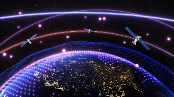
While local or dead reckoning positioning techniques like SLAM, INS and others will continue to be important, there will still always be a need for absolute positioning in a global reference frame, and satellite-based systems seem to be the best approach for the foreseeable future. An important hot topic in space-based PNT is the use of low-Earth orbit (LEO) satellites, a technique known as LEO PNT. One issue yet to play out is whether the services offered will be sufficiently compelling to allow return on investment and reach the levels of uptake required to create a truly alternative approach to current GNSS.
Thinking even more futuristically, we may eventually see a move away from using terrestrial or space-based infrastructure to positioning directly in the Earth’s gravity and/or magnetic fields.
Another important development will be the rise of AI, machine learning and quantum algorithms for improving the performance of all PNT techniques. They offer significant potential for improvement using only software, without the need for new infrastructure or user hardware.
Finally, while I have concentrated a lot on technology, none of the developments I have covered would have happened without the work of clever, dedicated people. My memories of all these developments are inextricably linked to the great people that made them happen. In the first 50 years of GPS, Australia has developed a strong reputation as a country that bats above it weight in GNSS and PNT, and we need to ensure that we continue to nurture and grow our PNT experts of the future.


