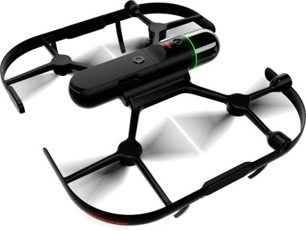
The Leica BLK2FLY is an autonomous flying laser scanner with built-in obstacle avoidance capabilities for reality capture of building exteriors, structures and environments and creation of 3D point clouds while flying.
With a few simple taps on a tablet, users can send it aloft to autonomously scan building exteriors and features, including hard-to-access areas such as rooftops and facades.
The device features GrandSLAM sensor fusion of LiDAR, radar, cameras and GNSS for full scan coverage, along with optimised flight paths and a shortest-return-to-home function. Users control the BLK2FLY through the BLK2FLY Live App on a tablet with no need for prior UAV experience — once the user has selected an area within a map on their tablet, the BLK2FLY will create its own flight path.
The unit includes WLAN and LTE connections to the tablet for nearly unlimited communication range during flight.