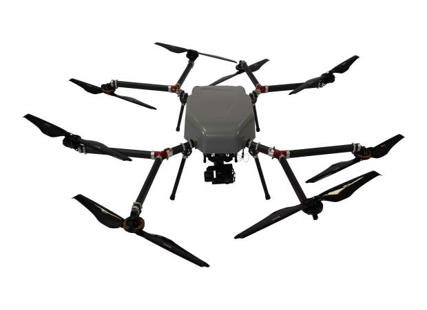
The Perimeter XLRS can fly for up to 5 hours while maintaining command and control links and streaming real-time video up to 100 km.
Hybrid-electric unmanned aerial vehicles specialist Skyfront, and multi-input multi-output (MIMO) communications company Silvus Technologies have formed a partnership that combines Skyfront’s five-hour endurance Perimeter UAV with Silvus’ high-power StreamCaster radios. The combined product, the Perimeter XLRS, can fly for up to five hours while maintaining command and control links and streaming real-time video up to 100 km from the ground control station.
This UAV enables operators to inspect pipelines and power lines and perform surveillance missions. The Perimeter’s on-board StreamCaster radio provides the unit with a steady, reliable video and control link. StreamCaster’s MIMO and beamforming technologies successfully overcome range limitations, signal attenuation and multipath interference, to allow the Perimeter XLRS to operate in environments where other data links typically fail, such as in maritime, mountain, and jungle deployments.
The Perimeter XLRS’s integration of the StreamCaster is comprehensive. It includes:
- Latency-free manual/joystick and waypoint control up to 60 miles away.
- RF/EMI protection from the powerful on-board radio.
- Testing and integration with numerous sensor payloads.
- H264/H265 encoding for any HDMI-output camera.
- A fully integrated ground station with directional ground antennas.
- Seamless power and harnessing.
- AES256-encrypted video and control links.
- Elimination of interference between GNSS unit and radio.
“The integration of the StreamCaster into the Perimeter line of UAV has enabled it to fully utilise its extreme endurance and fly beyond-line-of-sight (BVLOS) missions with ease,” said Troy Mestler, CEO of Skyfront.