

Users of the NSW Government’s SEED environment datasets portal can now take advantage of improved functionality through the introduction of an enhanced Layer Intersect Tool.
As of mid-November 2025, the SEED Layer Intersect Tool (LIT) provides:
- A more intuitive user experience;
- Expanded functionality and increased flexibility;
- A redesigned step-by-step interface;
- New geometry source options;
- Removal of the restrictive area limit; and
- Compatible SEED Map layers.
This all means that users can perform more customised assessments to unlock data insights that go beyond biodiversity and allow for any spatial data combination.
The LIT interface has been enhanced to provide a step-by-step process that gives clearer access to tool functionality as well as the option for Simple and Detailed reports.
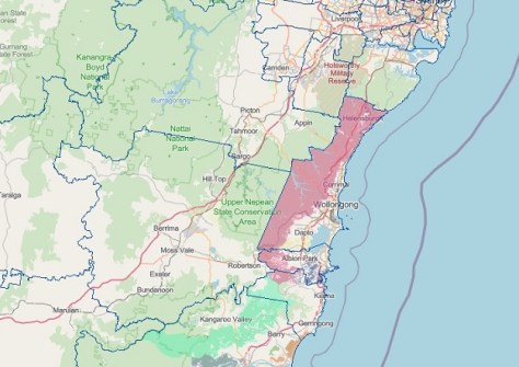
An additional Area of Interest, ‘Select by location,’ has been added, which enables SEED Map layer features to be used. According to SEED, ‘high-value’ administrative layers such as Lot, LGA, National Park, and Regional Planning Areas, will be made available.
The area limitation of 2,000 hectares has been removed, with the new limit being simply the number of records the LIT can process in an acceptable time. Users can first run a feasibility check to see if they need to refine the area of interest, or just choose a Simple Report if the area is too large.
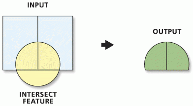
Any compatible layer can be used, with users able to select any feature layers in the SEED Map to find ‘what is inside’ an area of interest. This expands the use of LIT from solely biodiversity assessment analysis to any combination of SEED Map layers.
SEED is the NSW Government’s central resource for Sharing and Enabling Environmental Data. It contains numerous datasets within the broad categories of:
- Biota
- Boundaries (such as LGAs)
- Environment
- Climatology, meteorology and atmosphere
- Economy
- Elevation
- Farming
- Geoscientific information
- Imagery basemaps and Earth cover
- Inland waters
- Oceans
- Planning cadastre
- Society
- Utilities and communication
According to the SEED website, the most popular datasets over the past couple of months have been:
A simple ‘How to’ guide for the LIT is available online. In addition, SEED Hubs are available for users to learn more and join discussion fora for categories such as water, imagery, air quality, natural hazards and so on.


