Electric grid geospatial solution

By on 13 March, 2025
Electrical grid utility workers aboard a cherrypicker, working on a power pole

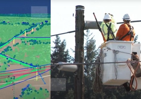
Teledyne Geospatial and Pointerra3D have announced a partnership for management in the electrical grid utility industry.

The deal introduces the Network Surveyor bundle, which combines Teledyne Geospatial’s airborne acquisition technology with Pointerra3D’s software suite.

The companies say the integrated solution dramatically reduces the time required to transform airborne 3D data into actionable insight on the health of electrical grid utility infrastructure.

Pointerra3D is a geospatial web mapping SaaS solution that enables collected digital twin data to become more accessible through end-to-end cloud-based workflows, storage and compute resources.

You may also like to read:


, , , , ,


Newsletter

Sign up now to stay up to date about all the news from Spatial Source. You will get a newsletter every week with the latest news.

GIS, AI to the rescue for the Great Barrier Reef
Australian researchers are designing a global real-time moni...
AI used to produce 30m-resolution global DEM
Fathom says the novel use of AI gives the most accurate publ...
Melissa Harris to head Geoscience Australia
Harris will become CEO of the geoscience agency in February,...
Topcon, FARO ink laser scanning agreement
The companies say they will develop laser scanning solutions...