

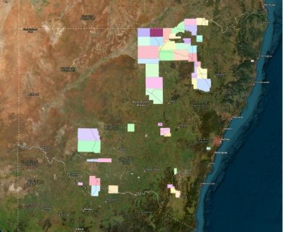
NSW’s DCS Spatial Services has added 97,085 square kilometres of newly captured elevation data to Geoscience Australia’s Elevation and Depth – Foundation Spatial Data (ELVIS) portal.
The update covers 48 areas across the state and comprises point clouds and digital elevation models.
The airborne LiDAR-gathered information can be freely downloaded via the portal.
According to DCS Spatial Services, “This data is a game-changer for agencies and organisations planning and managing land and natural environments”.
“From infrastructure development to environmental sustainability, these insights help deliver smarter decisions and better outcomes for NSW communities.”
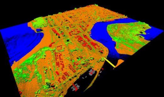
ELVIS is described as a cloud-based system that enables users to search and obtain elevation and bathymetry data available within their area of interest.
Developed as a collaboration between participating agencies under the Intergovernmental Committee on Surveying and Mapping, it provides a central source for open data from Commonwealth, state and territory governments.


