Calendar

Mon Tue Wed Thu Fri Sat Sun
1
2
3
4
5
FOSS4G SotM Oceania
FOSS4G SotM Oceania @ Hobart, Tasmania
Nov 5 – Nov 8 all-day
FOSS4G SotM Oceania @ Hobart, Tasmania
FOSS4G SotM Oceania will be a gathering enabling the open geospatial community to come together and ‘geek out’ over all things open geospatial. FOSS4G events are part of a conference series run by the OSGeo[...]
6
7
8
2024 Western Australian Geospatial Conference & Excellence Awards 8:30 am
2024 Western Australian Geospatial Conference & Excellence Awards @ The Maali at Perth Zoo
Nov 8 @ 8:30 am – 5:00 pm
2024 Western Australian Geospatial Conference & Excellence Awards @ The Maali at Perth Zoo
The 2024 Western Australian Geospatial Conference will be a dive deep into the latest technologies, trends, and best practices shaping the geospatial sector in Australia. The conference will give professionals ranging from GIS specialists to[...]
9
10
11
12
13
14
15
16
17
18
19
20
GIS Day 2024
GIS Day 2024
Nov 20 all-day
GIS Day 2024
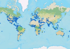
GIS Day is an international day dedicated to showing, teaching and inspiring others. Businesses and organisations are encouraged to host an event to spread enthusiasm and help people learn how to use GIS for themselves[...]
21
2024 ACT Geospatial Conference & Excellence Awards 9:00 am
2024 ACT Geospatial Conference & Excellence Awards @ Mercure Belconnen, Canberra
Nov 21 @ 9:00 am – 7:30 pm
2024 ACT Geospatial Conference & Excellence Awards @ Mercure Belconnen, Canberra
The 2024 ACT Geospatial Conference will be a dive deep into the latest technologies, trends, and best practices shaping the geospatial sector in Australia. The event will give professionals ranging from GIS specialists to remote[...]
22
23
24
25
2024 Pacific Islands GIS & Remote Sensing Users Conference 9:00 am
2024 Pacific Islands GIS & Remote Sensing Users Conference @ TBA
Nov 25 @ 9:00 am – Nov 29 @ 5:00 pm
2024 Pacific Islands GIS & Remote Sensing Users Conference @ TBA
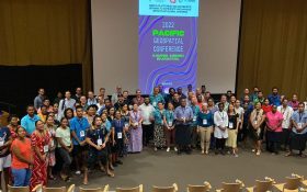
The 2024 Pacific Islands GIS & Remote Sensing Users Conference is reputably the largest GIS and remote sensing conference attended by Pacific Islanders, who leverage this annual opportunity to network and pursue partnerships with practitioners[...]
26
27
28
29
30

Newsletter

Sign up now to stay up to date about all the news from Spatial Source. You will get a newsletter every week with the latest news.

Q&A with Zaffar Sadiq Mohamed-Ghouse
Combatting climate change, saving lives and building better ...
Satellite imagery helps coastal data collection
A new study highlights the accuracy of satellite-derived bat...
Geospatial in School Awards recipients announced
Two outstanding teachers and a high school student have been...
The geospatial reality capture revolution
Aptella’s solutions are transforming spatial data and revo...
Evolution in survey: XGRIDS and Gaussian splats
Using 3DGS and SLAM technology, XGRIDS bridges the gap betwe...
Emlid joins Esri’s global Partner Network
The move will enable Esri ArcGIS users to take advantage of ...